Area Overview for ME19 6QN
Photos of ME19 6QN
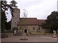
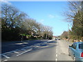
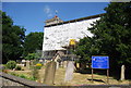
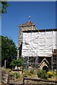
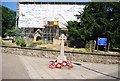
62 photos from this area
Area Information
Key information about the ME19 6QN including its size, population, and administrative classification.
- Area Type
- Postcode
- Area Size
- 2.9 hectares
- Population
- 1474
- Population Density
- 735 people/km²
House Prices in ME19 6QN
28
Properties
£414,119
Average Sold Price
£45,000
Lowest Price
£1,133,030
Highest Price
Showing 28 properties
| Address | Type | Beds | Baths | Last Sale Price | Last Sale Date | |
|---|---|---|---|---|---|---|
| 34 Town Hill, West Malling, ME19 6QN | house | - | - | £382,500 | Mar 2024 | |
| 50 Town Hill, West Malling, ME19 6QN | Detached | 4 | 2 | £1,133,030 | May 2023 | |
| 32 Town Hill, West Malling, ME19 6QN | Terraced | 2 | 1 | £375,000 | May 2022 | |
| 60 Town Hill, West Malling, ME19 6QN | Bungalow | - | - | £650,000 | Jul 2019 | |
| 18 Town Hill, West Malling, ME19 6QN | Semi-detached | 4 | 2 | £775,000 | Oct 2018 | |
| 46 Town Hill, West Malling, ME19 6QN | house | - | - | £1,030,000 | Jun 2018 | |
| 40 Town Hill, West Malling, ME19 6QN | house | - | - | £315,000 | Apr 2017 | |
| 38 Town Hill, West Malling, ME19 6QN | house | 3 | 1 | £660,000 | Jul 2015 | |
| 24 Town Hill, West Malling, ME19 6QN | house | - | - | £290,000 | May 2010 | |
| 26 Town Hill, West Malling, ME19 6QN | Terraced | - | - | £295,000 | Apr 2007 |
Page 1 of 3
Energy Efficiency in ME19 6QN
Amenities
Schools
| Rank | School | Type | Entry gender | Ages |
|---|
Explore more schools in this area
Go to Schools tabDemographics
Household Size
Two person
most common
Accommodation Type
Houses
most common
Tenure
88
majority
Ethnic Group
White
most common
Religion
N/A
most common
Household Composition
N/A
most common
Age
47
median
Adults (30-64 years)
most common
Household Deprivation
N/A
with no deprivation
NS-SEC
47
in Lower managerial occupations
Explore more demographic insights in this area
Go to Demographics tabPlanning
Planning Constraints
- Flood RiskPremium
- Ramsar Wetland SitesPremium
- Area of Outstanding Natural BeautyPremium
- Protected Nature ReservePremium
- Protected WoodlandPremium