Area Overview for ME19 5TW
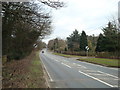
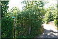
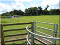
Photos of ME19 5TW


Area Information
Living in ME19 5TW offers a quiet, residential experience in a small cluster of homes. With a population of 2,323 spread across 109 people per square kilometre, the area feels compact yet cohesive. This postcode is defined by its low-rise housing stock, predominantly owner-occupied homes, and a community rooted in stability. The median age of 47 suggests a mature demographic, with most residents falling between 30 and 64 years old. Daily life here is likely characterised by a slower pace, with local amenities and schools within practical reach. The area’s proximity to railway stations and retail outlets adds convenience without the bustle of larger towns. While it lacks the density of urban centres, ME19 5TW provides a balance of privacy and accessibility, appealing to those seeking a settled, family-friendly environment. The absence of significant environmental constraints or flood risks further enhances its appeal as a safe, low-maintenance place to live.
- Area Type
- Postcode
- Area Size
- Not available
- Population
- 2323
- Population Density
- 109 people/km²
The property market in ME19 5TW is characterised by a high rate of home ownership (84%) and a predominance of houses over flats. This suggests a community of long-term residents, with fewer rental properties available. The small residential cluster means the housing stock is limited in scale, which could affect availability for buyers. The focus on owner-occupied homes indicates a market driven by family buyers seeking stability and space. Given the area’s low population density and compact size, property values may be influenced by proximity to local amenities and transport links. For buyers, this means a limited but potentially reliable market, with homes likely designed for long-term occupancy. The lack of high-rise or commercial development ensures the area retains its residential character, though the small size may limit options for those seeking larger properties.
House Prices in ME19 5TW
No properties found in this postcode.
Energy Efficiency in ME19 5TW
Residents of ME19 5TW have access to a range of retail and transport amenities within easy reach. The area is served by five retail outlets, including notable names like Waitrose Little Waitrose, Sainsburys Borough Green, and Co-op Borough. These shops provide convenience for daily shopping, from groceries to household essentials. The railway stations nearby—Borough Green & Wrotham, West Malling, and East Malling—offer regular services, connecting the area to broader transport networks. While the data does not specify parks or leisure facilities, the presence of multiple retail and transport hubs suggests a functional, community-focused lifestyle. The compact size of the area means amenities are close to homes, reducing the need for long commutes. This blend of retail and transport options supports a practical, accessible daily life, though further details on leisure or recreational spaces are not provided in the data.
Amenities
Schools
ME19 5TW is served by three primary schools, all of which are Church of England institutions. Offham Primary School and Trottiscliffe Church of England Primary School both hold a ‘good’ Ofsted rating, indicating a reliable standard of education. Stansted Church of England Primary School is listed but does not have an Ofsted rating provided. The presence of multiple primary schools within the area offers families flexibility and reduces the need for long commutes. The mix of schools, with two rated ‘good’, suggests a generally strong educational offering for younger children. However, the absence of secondary schools in the data means families may need to look further afield for secondary education. This cluster of primary schools supports the area’s appeal to families with young children, though parents should verify the specific curriculum and resources available at each school.
| Rank | School | Type | Entry gender | Ages |
|---|
Explore more schools in this area
Go to Schools tabDemographics
ME19 5TW’s population is predominantly composed of adults aged 30 to 64, with a median age of 47. This suggests a community of established professionals and families, rather than a younger, transient population. Home ownership is high at 84%, indicating a strong presence of long-term residents. The area is largely composed of houses, not flats, which aligns with the demographic profile of older, settled households. The predominant ethnic group is White, though no specific diversity statistics are provided. The age distribution and high home ownership rates imply a stable, low-turnover neighbourhood. This demographic profile may influence local services and amenities, which are tailored to the needs of middle-aged residents. The absence of significant deprivation data means the area likely enjoys a moderate to high quality of life, supported by its infrastructure and community cohesion.
Household Size
Accommodation Type
Tenure
Ethnic Group
Religion
Household Composition
Age
Household Deprivation
NS-SEC
Explore more demographic insights in this area
Go to Demographics tabPlanning
Planning Constraints
- Flood RiskPremium
- Ramsar Wetland SitesPremium
- Area of Outstanding Natural BeautyPremium
- Protected Nature ReservePremium
- Protected WoodlandPremium