Area Overview for ME19 5QS
Photos of ME19 5QS


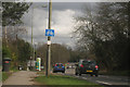
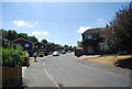
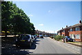
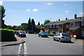
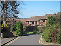
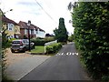


39 photos from this area
Area Information
Key information about the ME19 5QS including its size, population, and administrative classification.
- Area Type
- Postcode
- Area Size
- 2.7 hectares
- Population
- 1222
- Population Density
- 1847 people/km²
House Prices in ME19 5QS
54
Properties
£325,567
Average Sold Price
£103,000
Lowest Price
£605,000
Highest Price
Showing 54 properties
| Address | Type | Beds | Baths | Last Sale Price | Last Sale Date | |
|---|---|---|---|---|---|---|
| 63 Bridgewater Place, Leybourne, West Malling, ME19 5QS | Detached | 4 | 1 | £490,000 | Aug 2025 | |
| 74 Bridgewater Place, Leybourne, West Malling, ME19 5QS | Detached | 4 | - | £385,000 | Feb 2025 | |
| 42 Bridgewater Place, Leybourne, West Malling, ME19 5QS | Detached | 4 | 3 | £585,000 | May 2023 | |
| 71 Bridgewater Place, Leybourne, West Malling, ME19 5QS | Detached | 5 | 3 | £550,000 | Feb 2023 | |
| 59 Bridgewater Place, Leybourne, West Malling, ME19 5QS | house | 4 | 1 | £515,000 | Nov 2022 | |
| 47 Bridgewater Place, Leybourne, West Malling, ME19 5QS | house | 1 | 2 | £500,000 | Aug 2022 | |
| 75 Bridgewater Place, Leybourne, West Malling, ME19 5QS | Semi-detached | 3 | 1 | £376,000 | Jun 2022 | |
| 33 Bridgewater Place, Leybourne, West Malling, ME19 5QS | house | - | - | £605,000 | Nov 2021 | |
| 35 Bridgewater Place, Leybourne, West Malling, ME19 5QS | Detached | 4 | 2 | £465,000 | Apr 2021 | |
| 45 Bridgewater Place, Leybourne, West Malling, ME19 5QS | house | - | - | £442,500 | Jan 2021 |
Page 1 of 6
Energy Efficiency in ME19 5QS
Amenities
Schools
| Rank | School | Type | Entry gender | Ages |
|---|
Explore more schools in this area
Go to Schools tabDemographics
Household Size
Family (3-5 people)
most common
Accommodation Type
Houses
most common
Tenure
91
majority
Ethnic Group
White
most common
Religion
N/A
most common
Household Composition
N/A
most common
Age
47
median
Adults (30-64 years)
most common
Household Deprivation
N/A
with no deprivation
NS-SEC
48
in Lower managerial occupations
Explore more demographic insights in this area
Go to Demographics tabPlanning
Planning Constraints
- Flood RiskPremium
- Ramsar Wetland SitesPremium
- Area of Outstanding Natural BeautyPremium
- Protected Nature ReservePremium
- Protected WoodlandPremium