Area Overview for ME19 5QH
Photos of ME19 5QH


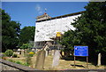


62 photos from this area
Area Information
Key information about the ME19 5QH including its size, population, and administrative classification.
- Area Type
- Postcode
- Area Size
- 4.1 hectares
- Population
- 1222
- Population Density
- 1847 people/km²
House Prices in ME19 5QH
61
Properties
£310,849
Average Sold Price
£51,000
Lowest Price
£675,000
Highest Price
Showing 61 properties
| Address | Type | Beds | Baths | Last Sale Price | Last Sale Date | |
|---|---|---|---|---|---|---|
| 56 Old Orchard Lane, Leybourne, West Malling, ME19 5QH | Terraced | 3 | 1 | £400,000 | Sep 2025 | |
| 61 Old Orchard Lane, Leybourne, West Malling, ME19 5QH | Detached | 4 | 2 | £675,000 | Dec 2024 | |
| 24 Old Orchard Lane, Leybourne, West Malling, ME19 5QH | Detached | 3 | 2 | £435,000 | Jul 2024 | |
| 7 Old Orchard Lane, Leybourne, West Malling, ME19 5QH | Detached | 3 | 1 | £400,000 | Jun 2023 | |
| 18 Old Orchard Lane, Leybourne, West Malling, ME19 5QH | Semi-detached | 4 | 3 | £470,000 | Jun 2022 | |
| 28 Old Orchard Lane, Leybourne, West Malling, ME19 5QH | house | - | - | £425,000 | Apr 2022 | |
| 51 Old Orchard Lane, Leybourne, West Malling, ME19 5QH | house | - | - | £372,500 | Mar 2022 | |
| 42 Old Orchard Lane, Leybourne, West Malling, ME19 5QH | house | 3 | - | £375,000 | Mar 2022 | |
| 52 Old Orchard Lane, Leybourne, West Malling, ME19 5QH | Retail | 3 | 2 | £430,000 | Jan 2022 | |
| 53 Old Orchard Lane, Leybourne, West Malling, ME19 5QH | house | - | - | £390,000 | Jun 2021 |
Page 1 of 7
Energy Efficiency in ME19 5QH
Amenities
Schools
| Rank | School | Type | Entry gender | Ages |
|---|
Explore more schools in this area
Go to Schools tabDemographics
Household Size
Family (3-5 people)
most common
Accommodation Type
Houses
most common
Tenure
91
majority
Ethnic Group
White
most common
Religion
N/A
most common
Household Composition
N/A
most common
Age
47
median
Adults (30-64 years)
most common
Household Deprivation
N/A
with no deprivation
NS-SEC
48
in Lower managerial occupations
Explore more demographic insights in this area
Go to Demographics tabPlanning
Planning Constraints
- Flood RiskPremium
- Ramsar Wetland SitesPremium
- Area of Outstanding Natural BeautyPremium
- Protected Nature ReservePremium
- Protected WoodlandPremium