Area Overview for ME19 5LU
Photos of ME19 5LU
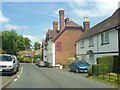
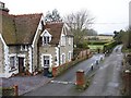

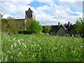
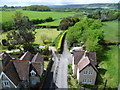
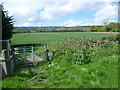
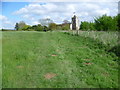
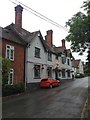
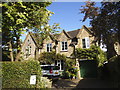
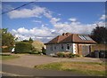
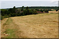
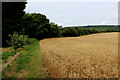
55 photos from this area
Area Information
Key information about the ME19 5LU including its size, population, and administrative classification.
- Area Type
- Postcode
- Area Size
- 1.0 hectares
- Population
- 1748
- Population Density
- 122 people/km²
House Prices in ME19 5LU
14
Properties
£341,650
Average Sold Price
£59,500
Lowest Price
£687,500
Highest Price
Showing 14 properties
| Address | Type | Beds | Baths | Last Sale Price | Last Sale Date | |
|---|---|---|---|---|---|---|
| 1 Chapel Street, Ryarsh, West Malling, ME19 5LU | Terraced | 3 | 1 | £365,000 | Feb 2025 | |
| 2 Chapel Street, Ryarsh, West Malling, ME19 5LU | Terraced | 4 | 2 | £360,000 | May 2024 | |
| Beau Voir, Chapel Street, Ryarsh, West Malling, ME19 5LU | Detached | 4 | 2 | £687,500 | Sep 2023 | |
| The Old Post Office, Chapel Street, Ryarsh, West Malling, ME19 5LU | house | 4 | - | £592,000 | Mar 2021 | |
| 3 Chapel Street, Ryarsh, West Malling, ME19 5LU | Terraced | 2 | 1 | £280,000 | May 2018 | |
| Hobbes Eares, Chapel Street, Ryarsh, West Malling, ME19 5LU | Terraced | 2 | - | £230,000 | Feb 2015 | |
| Hope Cottage, Chapel Street, Ryarsh, West Malling, ME19 5LU | Cottage | 3 | 1 | £332,500 | Jul 2013 | |
| 4 Chapel Street, Ryarsh, West Malling, ME19 5LU | Terraced | 4 | 2 | £285,000 | Apr 2007 | |
| Tywop, Chapel Street, Ryarsh, West Malling, ME19 5LU | Terraced | - | - | £224,995 | Apr 2007 | |
| Peak Revs, Chapel Street, Ryarsh, West Malling, ME19 5LU | Terraced | - | - | £59,500 | May 1996 |
Page 1 of 2
Energy Efficiency in ME19 5LU
Amenities
Schools
| Rank | School | Type | Entry gender | Ages |
|---|
Explore more schools in this area
Go to Schools tabDemographics
Household Size
Family (3-5 people)
most common
Accommodation Type
Houses
most common
Tenure
78
majority
Ethnic Group
White
most common
Religion
N/A
most common
Household Composition
N/A
most common
Age
47
median
Adults (30-64 years)
most common
Household Deprivation
N/A
with no deprivation
NS-SEC
46
in Lower managerial occupations
Explore more demographic insights in this area
Go to Demographics tabPlanning
Planning Constraints
- Flood RiskPremium
- Ramsar Wetland SitesPremium
- Area of Outstanding Natural BeautyPremium
- Protected Nature ReservePremium
- Protected WoodlandPremium