Area Overview for ME19 5LA
Photos of ME19 5LA
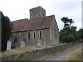

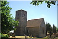
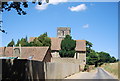


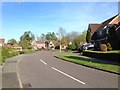
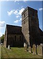
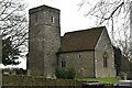
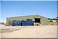
29 photos from this area
Area Information
Key information about the ME19 5LA including its size, population, and administrative classification.
- Area Type
- Postcode
- Area Size
- 17.8 hectares
- Population
- 1748
- Population Density
- 122 people/km²
House Prices in ME19 5LA
13
Properties
£719,167
Average Sold Price
£495,000
Lowest Price
£1,080,000
Highest Price
Showing 13 properties
| Address | Type | Beds | Baths | Last Sale Price | Last Sale Date | |
|---|---|---|---|---|---|---|
| Ramscombe Cottage, Roughetts Road, Ryarsh, West Malling, ME19 5LA | Detached | 4 | 2 | £1,080,000 | Dec 2024 | |
| The Coach House, Roughetts Road, Ryarsh, West Malling, ME19 5LA | Detached | 4 | 2 | £582,500 | Mar 2010 | |
| Manora, Roughetts Road, Ryarsh, West Malling, ME19 5LA | house | - | - | £495,000 | Jul 2009 | |
| 4, Brook Cottages, Roughetts Road, Ryarsh, West Malling, ME19 5LA | Terraced | 4 | 3 | - | - | |
| 3, Brook Cottages, Roughetts Road, Ryarsh, West Malling, ME19 5LA | Terraced | 3 | 3 | - | - | |
| Brook Farm, Holiday Accommodation, Roughetts Road, Ryarsh, West Malling, ME19 5LA | hotel | - | - | - | - | |
| The Old Vicarage, Roughetts Road, Ryarsh, West Malling, ME19 5LA | house | - | - | - | - | |
| Flat 1 At, Brook Farm, Roughetts Road, Ryarsh, West Malling, ME19 5LA | Flat | - | - | - | - | |
| Flat 2 At, Brook Farm, Roughetts Road, Ryarsh, West Malling, ME19 5LA | Flat | - | - | - | - | |
| Roughetts, Roughetts Road, Ryarsh, West Malling, ME19 5LA | Detached | - | - | - | - |
Page 1 of 2
Energy Efficiency in ME19 5LA
Amenities
Schools
| Rank | School | Type | Entry gender | Ages |
|---|
Explore more schools in this area
Go to Schools tabDemographics
Household Size
Family (3-5 people)
most common
Accommodation Type
Houses
most common
Tenure
78
majority
Ethnic Group
White
most common
Religion
N/A
most common
Household Composition
N/A
most common
Age
47
median
Adults (30-64 years)
most common
Household Deprivation
N/A
with no deprivation
NS-SEC
46
in Lower managerial occupations
Explore more demographic insights in this area
Go to Demographics tabPlanning
Planning Constraints
- Flood RiskPremium
- Ramsar Wetland SitesPremium
- Area of Outstanding Natural BeautyPremium
- Protected Nature ReservePremium