Area Overview for ME19 5JR
Photos of ME19 5JR
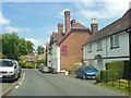
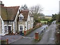

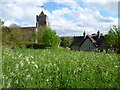
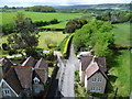
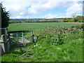
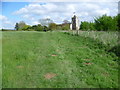
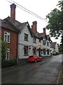
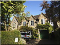
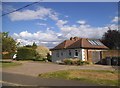
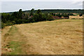

55 photos from this area
Area Information
Key information about the ME19 5JR including its size, population, and administrative classification.
- Area Type
- Postcode
- Area Size
- 14.4 hectares
- Population
- 1748
- Population Density
- 122 people/km²
House Prices in ME19 5JR
32
Properties
£460,666
Average Sold Price
£249,995
Lowest Price
£840,000
Highest Price
Showing 32 properties
| Address | Type | Beds | Baths | Last Sale Price | Last Sale Date | |
|---|---|---|---|---|---|---|
| Whipsiderry, 31 Ryarsh Road, Birling, West Malling, ME19 5JR | house | - | - | £780,000 | Jan 2025 | |
| 57 Ryarsh Road, Birling, West Malling, ME19 5JR | Terraced | 3 | 1 | £475,000 | Dec 2024 | |
| 83 Ryarsh Road, Birling, West Malling, ME19 5JR | Detached | 4 | 2 | £840,000 | Sep 2024 | |
| 45 Ryarsh Road, Birling, West Malling, ME19 5JR | Semi-detached | 4 | 1 | £710,000 | Jul 2023 | |
| Frindale Cottage, 80 Ryarsh Road, Birling, West Malling, ME19 5JR | Terraced | - | - | £395,000 | Feb 2021 | |
| 90 Ryarsh Road, Birling, West Malling, ME19 5JR | Detached | 4 | 3 | £578,000 | Feb 2018 | |
| 55 Ryarsh Road, Birling, West Malling, ME19 5JR | house | - | - | £335,000 | Jan 2016 | |
| 65 Ryarsh Road, Birling, West Malling, ME19 5JR | Terraced | 3 | 1 | £315,000 | Sep 2012 | |
| Foxglove Cottage, 39 Ryarsh Road, Birling, West Malling, ME19 5JR | house | - | - | £292,000 | Nov 2009 | |
| Freeway, 47 Ryarsh Road, Birling, West Malling, ME19 5JR | Detached | - | - | £250,000 | Oct 2006 |
Page 1 of 4
Energy Efficiency in ME19 5JR
Amenities
Schools
| Rank | School | Type | Entry gender | Ages |
|---|
Explore more schools in this area
Go to Schools tabDemographics
Household Size
Family (3-5 people)
most common
Accommodation Type
Houses
most common
Tenure
78
majority
Ethnic Group
White
most common
Religion
N/A
most common
Household Composition
N/A
most common
Age
47
median
Adults (30-64 years)
most common
Household Deprivation
N/A
with no deprivation
NS-SEC
46
in Lower managerial occupations
Explore more demographic insights in this area
Go to Demographics tabPlanning
Planning Constraints
- Flood RiskPremium
- Ramsar Wetland SitesPremium
- Area of Outstanding Natural BeautyPremium
- Protected Nature ReservePremium
- Protected WoodlandPremium