Area Overview for ME19 5JQ
Photos of ME19 5JQ


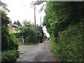
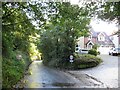
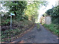


19 photos from this area
Area Information
Key information about the ME19 5JQ including its size, population, and administrative classification.
- Area Type
- Postcode
- Area Size
- 46.5 hectares
- Population
- 1748
- Population Density
- 122 people/km²
House Prices in ME19 5JQ
7
Properties
£595,500
Average Sold Price
£129,000
Lowest Price
£1,065,000
Highest Price
Showing 7 properties
| Address | Type | Beds | Baths | Last Sale Price | Last Sale Date | |
|---|---|---|---|---|---|---|
| Laundry Cottage, 281-283 Snodland Road, Birling, West Malling, ME19 5JQ | house | 5 | - | £1,065,000 | May 2021 | |
| 251 Snodland Road, Birling, West Malling, ME19 5JQ | house | 4 | - | £592,500 | Dec 2011 | |
| 249 Snodland Road, Birling, West Malling, ME19 5JQ | Semi-detached | - | - | £129,000 | Jun 1997 | |
| Former, 285A Snodland Road, Birling, West Malling, ME19 5JQ | Detached | 9 | 8 | - | - | |
| Langold House, 285 Snodland Road, Birling, West Malling, ME19 5JQ | Detached | 9 | 8 | - | - | |
| Annexe At, Laundry Cottage, 281-283 Snodland Road, Birling, West Malling, ME19 5JQ | Detached | - | - | - | - | |
| Tennis 84M From 285 Snodland Road 54M From Unnamed Road, Snodland Road, Birling, West Malling, ME19 5JQ | Leisure | - | - | - | - |
Energy Efficiency in ME19 5JQ
Amenities
Schools
| Rank | School | Type | Entry gender | Ages |
|---|
Explore more schools in this area
Go to Schools tabDemographics
Household Size
Family (3-5 people)
most common
Accommodation Type
Houses
most common
Tenure
78
majority
Ethnic Group
White
most common
Religion
N/A
most common
Household Composition
N/A
most common
Age
47
median
Adults (30-64 years)
most common
Household Deprivation
N/A
with no deprivation
NS-SEC
46
in Lower managerial occupations
Explore more demographic insights in this area
Go to Demographics tabPlanning
Planning Constraints
- Flood RiskPremium
- Ramsar Wetland SitesPremium
- Area of Outstanding Natural BeautyPremium
- Protected Nature ReservePremium
- Protected WoodlandPremium