Area Overview for ME19 4QS
Photos of ME19 4QS

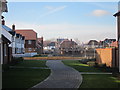
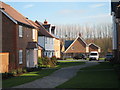
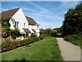
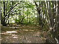
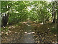
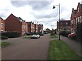
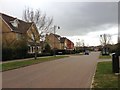
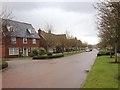
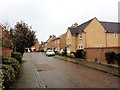
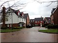
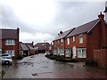
55 photos from this area
Area Information
Key information about the ME19 4QS including its size, population, and administrative classification.
- Area Type
- Postcode
- Area Size
- 1.7 hectares
- Population
- 2983
- Population Density
- 2036 people/km²
House Prices in ME19 4QS
45
Properties
£436,225
Average Sold Price
£179,000
Lowest Price
£917,950
Highest Price
Showing 45 properties
| Address | Type | Beds | Baths | Last Sale Price | Last Sale Date | |
|---|---|---|---|---|---|---|
| 8 Waterloo Walk, Kings Hill, West Malling, ME19 4QS | Detached | 5 | 3 | £725,000 | Nov 2024 | |
| 10 Waterloo Walk, Kings Hill, West Malling, ME19 4QS | Detached | 4 | 3 | £622,500 | Jul 2024 | |
| 35 Waterloo Walk, Kings Hill, West Malling, ME19 4QS | house | - | - | £425,000 | Jul 2023 | |
| 19 Waterloo Walk, Kings Hill, West Malling, ME19 4QS | Retail | 4 | 2 | £587,500 | Dec 2022 | |
| 1 Waterloo Walk, Kings Hill, West Malling, ME19 4QS | Terraced | 2 | 1 | £575,000 | Dec 2021 | |
| 34 Waterloo Walk, Kings Hill, West Malling, ME19 4QS | Detached | 4 | 3 | £535,000 | Mar 2020 | |
| 41 Waterloo Walk, Kings Hill, West Malling, ME19 4QS | Terraced | 2 | 2 | £311,050 | Oct 2018 | |
| 31 Waterloo Walk, Kings Hill, West Malling, ME19 4QS | Terraced | 2 | 1 | £304,500 | Sep 2018 | |
| 6 Waterloo Walk, Kings Hill, West Malling, ME19 4QS | Detached | 5 | 3 | £595,000 | Jun 2018 | |
| 23 Waterloo Walk, Kings Hill, West Malling, ME19 4QS | house | - | - | £695,000 | May 2017 |
Page 1 of 5
Energy Efficiency in ME19 4QS
Amenities
Schools
| Rank | School | Type | Entry gender | Ages |
|---|
Explore more schools in this area
Go to Schools tabDemographics
Household Size
Family (3-5 people)
most common
Accommodation Type
Houses
most common
Tenure
76
majority
Ethnic Group
White
most common
Religion
N/A
most common
Household Composition
N/A
most common
Age
47
median
Adults (30-64 years)
most common
Household Deprivation
N/A
with no deprivation
NS-SEC
49
in Lower managerial occupations
Explore more demographic insights in this area
Go to Demographics tabPlanning
Planning Constraints
- Flood RiskPremium
- Ramsar Wetland SitesPremium
- Area of Outstanding Natural BeautyPremium
- Protected Nature ReservePremium
- Protected WoodlandPremium