Area Overview for ME19 4FF
Photos of ME19 4FF


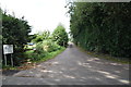
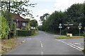
37 photos from this area
Area Information
Key information about the ME19 4FF including its size, population, and administrative classification.
- Area Type
- Postcode
- Area Size
- 16.9 hectares
- Population
- 1986
- Population Density
- 363 people/km²
House Prices in ME19 4FF
63
Properties
£596,891
Average Sold Price
£325,000
Lowest Price
£1,250,000
Highest Price
Showing 63 properties
| Address | Type | Beds | Baths | Last Sale Price | Last Sale Date | |
|---|---|---|---|---|---|---|
| 2 Shoesmith Lane, Kings Hill, West Malling, ME19 4FF | house | 2 | 2 | £600,000 | Oct 2024 | |
| 52 Shoesmith Lane, Kings Hill, West Malling, ME19 4FF | Terraced | 4 | 2 | £540,000 | Sep 2024 | |
| 9 Shoesmith Lane, Kings Hill, West Malling, ME19 4FF | Flat | 4 | - | £465,000 | Mar 2023 | |
| 45 Shoesmith Lane, Kings Hill, West Malling, ME19 4FF | Detached | 4 | 2 | £645,000 | Aug 2022 | |
| 29 Shoesmith Lane, Kings Hill, West Malling, ME19 4FF | house | 5 | 3 | £910,000 | Apr 2022 | |
| 48 Shoesmith Lane, Kings Hill, West Malling, ME19 4FF | Semi-detached | 5 | 3 | £540,000 | Jun 2021 | |
| The Cobbler, 23 Shoesmith Lane, Kings Hill, West Malling, ME19 4FF | house | - | - | £760,000 | May 2021 | |
| 53 Shoesmith Lane, Kings Hill, West Malling, ME19 4FF | house | 5 | - | £400,000 | Feb 2021 | |
| 38 Shoesmith Lane, Kings Hill, West Malling, ME19 4FF | house | 4 | 2 | £540,000 | Oct 2019 | |
| 28 Shoesmith Lane, Kings Hill, West Malling, ME19 4FF | house | - | - | £1,250,000 | Jan 2019 |
Page 1 of 7
Energy Efficiency in ME19 4FF
Amenities
Schools
| Rank | School | Type | Entry gender | Ages |
|---|
Explore more schools in this area
Go to Schools tabDemographics
Household Size
Two person
most common
Accommodation Type
Houses
most common
Tenure
73
majority
Ethnic Group
White
most common
Religion
N/A
most common
Household Composition
N/A
most common
Age
47
median
Adults (30-64 years)
most common
Household Deprivation
N/A
with no deprivation
NS-SEC
44
in Lower managerial occupations
Explore more demographic insights in this area
Go to Demographics tabPlanning
Planning Constraints
- Flood RiskPremium
- Ramsar Wetland SitesPremium
- Area of Outstanding Natural BeautyPremium
- Protected Nature ReservePremium
- Protected WoodlandPremium