Area Overview for ME19 4EG
Photos of ME19 4EG

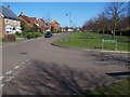

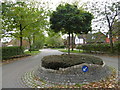
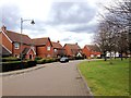
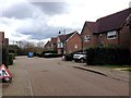
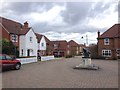
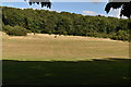
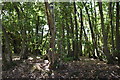
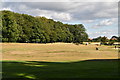
37 photos from this area
Area Information
Key information about the ME19 4EG including its size, population, and administrative classification.
- Area Type
- Postcode
- Area Size
- 12.6 hectares
- Population
- 1976
- Population Density
- 366 people/km²
House Prices in ME19 4EG
14
Properties
£371,014
Average Sold Price
£148,000
Lowest Price
£691,000
Highest Price
Showing 14 properties
| Address | Type | Beds | Baths | Last Sale Price | Last Sale Date | |
|---|---|---|---|---|---|---|
| 12 Montfort Drive, Kings Hill, West Malling, ME19 4EG | house | - | - | £691,000 | Dec 2020 | |
| 2 Montfort Drive, Kings Hill, West Malling, ME19 4EG | house | - | - | £650,000 | Mar 2016 | |
| 6 Montfort Drive, Kings Hill, West Malling, ME19 4EG | house | - | - | £620,000 | Sep 2013 | |
| 5 Montfort Drive, Kings Hill, West Malling, ME19 4EG | Detached | - | - | £499,999 | Dec 2006 | |
| 4 Montfort Drive, Kings Hill, West Malling, ME19 4EG | Detached | - | - | £410,000 | May 2004 | |
| 3 Montfort Drive, Kings Hill, West Malling, ME19 4EG | Detached | - | - | £420,000 | May 2004 | |
| 14 Montfort Drive, Kings Hill, West Malling, ME19 4EG | Detached | - | - | £301,000 | Jan 2004 | |
| 1 Montfort Drive, Kings Hill, West Malling, ME19 4EG | Detached | - | - | £275,250 | Jul 2002 | |
| 13 Montfort Drive, Kings Hill, West Malling, ME19 4EG | Detached | - | - | £316,000 | Sep 2001 | |
| 7 Montfort Drive, Kings Hill, West Malling, ME19 4EG | Detached | - | - | £277,000 | Mar 2000 |
Page 1 of 2
Energy Efficiency in ME19 4EG
Amenities
Schools
| Rank | School | Type | Entry gender | Ages |
|---|
Explore more schools in this area
Go to Schools tabDemographics
Household Size
Two person
most common
Accommodation Type
Houses
most common
Tenure
78
majority
Ethnic Group
White
most common
Religion
N/A
most common
Household Composition
N/A
most common
Age
47
median
Adults (30-64 years)
most common
Household Deprivation
N/A
with no deprivation
NS-SEC
45
in Lower managerial occupations
Explore more demographic insights in this area
Go to Demographics tabPlanning
Planning Constraints
- Flood RiskPremium
- Ramsar Wetland SitesPremium
- Area of Outstanding Natural BeautyPremium
- Protected Nature ReservePremium
- Protected WoodlandPremium