Area Overview for ME19 4BF
Photos of ME19 4BF

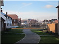
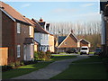
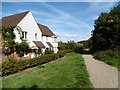
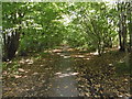
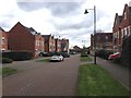
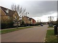
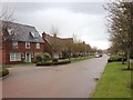
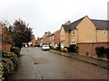
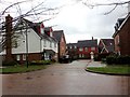
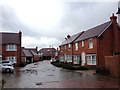
55 photos from this area
Area Information
Key information about the ME19 4BF including its size, population, and administrative classification.
- Area Type
- Postcode
- Area Size
- 9189 m²
- Population
- 1732
- Population Density
- 3172 people/km²
House Prices in ME19 4BF
30
Properties
£399,904
Average Sold Price
£283,000
Lowest Price
£732,000
Highest Price
Showing 30 properties
| Address | Type | Beds | Baths | Last Sale Price | Last Sale Date | |
|---|---|---|---|---|---|---|
| 5 Kendall Avenue, Kings Hill, West Malling, ME19 4BF | Terraced | 4 | 3 | £558,000 | Oct 2023 | |
| 10 Kendall Avenue, Kings Hill, West Malling, ME19 4BF | house | 3 | 3 | £495,000 | May 2022 | |
| 28 Kendall Avenue, Kings Hill, West Malling, ME19 4BF | house | - | - | £510,000 | Oct 2021 | |
| 4 Kendall Avenue, Kings Hill, West Malling, ME19 4BF | Semi-detached | 4 | 2 | £485,000 | Sep 2020 | |
| 22 Kendall Avenue, Kings Hill, West Malling, ME19 4BF | Terraced | 3 | - | £423,500 | Jun 2019 | |
| 15 Kendall Avenue, Kings Hill, West Malling, ME19 4BF | house | - | - | £410,000 | Mar 2019 | |
| 1 Kendall Avenue, Kings Hill, West Malling, ME19 4BF | Semi-detached | 3 | 2 | £732,000 | Aug 2017 | |
| 30 Kendall Avenue, Kings Hill, West Malling, ME19 4BF | Terraced | 3 | 3 | £419,950 | Apr 2017 | |
| 24 Kendall Avenue, Kings Hill, West Malling, ME19 4BF | house | - | - | £399,995 | Jul 2016 | |
| 13 Kendall Avenue, Kings Hill, West Malling, ME19 4BF | house | - | - | £400,000 | Jan 2016 |
Page 1 of 3
Energy Efficiency in ME19 4BF
Amenities
Schools
| Rank | School | Type | Entry gender | Ages |
|---|
Explore more schools in this area
Go to Schools tabDemographics
Household Size
Family (3-5 people)
most common
Accommodation Type
Houses
most common
Tenure
80
majority
Ethnic Group
White
most common
Religion
N/A
most common
Household Composition
N/A
most common
Age
47
median
Adults (30-64 years)
most common
Household Deprivation
N/A
with no deprivation
NS-SEC
54
in Lower managerial occupations
Explore more demographic insights in this area
Go to Demographics tabPlanning
Planning Constraints
- Flood RiskPremium
- Ramsar Wetland SitesPremium
- Area of Outstanding Natural BeautyPremium
- Protected Nature ReservePremium
- Protected WoodlandPremium