Area Overview for ME18 5AG
Photos of ME18 5AG
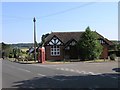

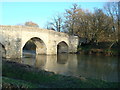

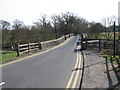
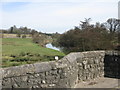
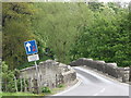
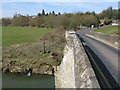
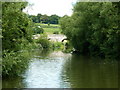

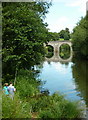
100 photos from this area
Area Information
Key information about the ME18 5AG including its size, population, and administrative classification.
- Area Type
- Postcode
- Area Size
- 1.3 hectares
- Population
- 2389
- Population Density
- 416 people/km²
House Prices in ME18 5AG
20
Properties
£371,200
Average Sold Price
£115,000
Lowest Price
£650,000
Highest Price
Showing 20 properties
| Address | Type | Beds | Baths | Last Sale Price | Last Sale Date | |
|---|---|---|---|---|---|---|
| Trowfair, Church Street, Teston, ME18 5AG | Bungalow | - | - | £435,000 | Jul 2023 | |
| Waycot, Church Street, Teston, ME18 5AG | Bungalow | 2 | 1 | £650,000 | Aug 2022 | |
| Fairlawn Cottage, Church Street, Teston, ME18 5AG | Detached | 4 | 1 | £635,000 | Apr 2018 | |
| Ronda, Church Street, Teston, ME18 5AG | Semi-detached | 4 | 1 | £490,000 | Jul 2017 | |
| Ragstones, Church Street, Teston, ME18 5AG | Bungalow | - | - | £312,000 | May 2013 | |
| Four Throws, Church Street, Teston, ME18 5AG | Bungalow | 2 | - | £115,000 | Apr 2013 | |
| Moordown, Church Street, Teston, ME18 5AG | house | - | - | £435,000 | Sep 2011 | |
| Carolcott, Church Street, Teston, ME18 5AG | Bungalow | - | - | £205,000 | Mar 2010 | |
| Riverview, Church Street, Teston, ME18 5AG | Detached | 2 | - | £305,000 | Mar 2005 | |
| Farleigh Cottage, Church Street, Teston, ME18 5AG | Semi-detached | 3 | 1 | £130,000 | Jun 2001 |
Page 1 of 2
Energy Efficiency in ME18 5AG
Amenities
Schools
| Rank | School | Type | Entry gender | Ages |
|---|
Explore more schools in this area
Go to Schools tabDemographics
Household Size
Two person
most common
Accommodation Type
Houses
most common
Tenure
91
majority
Ethnic Group
White
most common
Religion
N/A
most common
Household Composition
N/A
most common
Age
47
median
Adults (30-64 years)
most common
Household Deprivation
N/A
with no deprivation
NS-SEC
41
in Lower managerial occupations
Explore more demographic insights in this area
Go to Demographics tabPlanning
Planning Constraints
- Flood RiskPremium
- Ramsar Wetland SitesPremium
- Area of Outstanding Natural BeautyPremium
- Protected Nature ReservePremium
- Protected WoodlandPremium