Area Overview for ME17 2WQ
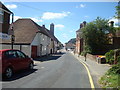
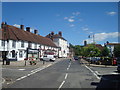
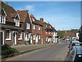
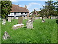
Photos of ME17 2WQ


Area Information
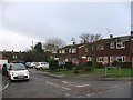
ME17 2WQ is a small residential postcode area in England, home to just 1897 people spread across a low-density settlement. The area’s compact size fosters a close-knit community feel, with homes predominantly occupied by owners rather than renters. With a median age of 47, the population skews towards adults aged 30–64, suggesting a stable demographic profile. Daily life here is shaped by proximity to essential services, including two well-regarded primary schools and a network of rail stations. The area’s low population density means a quieter, more suburban character, though residents still have access to nearby amenities. For those seeking a balance between tranquillity and practicality, ME17 2WQ offers a straightforward lifestyle. The absence of major environmental constraints or flood risks adds to its appeal, while the local rail links provide connectivity to larger towns. This is an area where convenience and simplicity coexist, ideal for families or individuals prioritising stability over urban vibrancy.
- Area Type
- Postcode
- Area Size
- Not available
- Population
- 1897
- Population Density
- 88 people/km²
The property market in ME17 2WQ is characterised by a high rate of home ownership, with 79% of properties occupied by owners rather than renters. This suggests a market driven by long-term residents rather than speculative investment. The accommodation type is predominantly houses, which are more common in smaller, rural or semi-rural postcode areas. This housing stock likely appeals to families or individuals seeking space and privacy, though the small size of the area means the selection of properties is limited. Buyers should consider that the market is not heavily influenced by rental demand, as the owner-occupation rate is high. The absence of large-scale development or planning constraints means property values are likely stable, with limited pressure for rapid price increases. For those seeking a home in this area, the focus is on securing a family-friendly property in a low-density setting, rather than navigating a competitive or rapidly evolving market.
House Prices in ME17 2WQ
No properties found in this postcode.
Energy Efficiency in ME17 2WQ
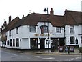
The lifestyle in ME17 2WQ is shaped by its proximity to retail and transport hubs. Within practical reach, residents have access to four retail outlets, including The Southern Co-operative Co, Morrisons Daily, and M&S Lenham BP SF. These shops provide essentials and everyday conveniences, reducing the need for long trips to larger centres. The area’s rail stations—Lenham, Harrietsham, and Charing—enhance mobility, connecting residents to nearby towns for more specialised services or leisure activities. While the data does not specify parks or leisure facilities, the low population density and absence of environmental constraints suggest open spaces may be available for recreation. The combination of retail options and rail connectivity ensures a functional, low-stress lifestyle, ideal for those prioritising practicality over urban amenities. The area’s character is one of simplicity, where daily needs are met locally, and travel is efficient for those requiring it.
Amenities
Schools
Residents of ME17 2WQ have access to two primary schools within practical reach: Lenham Primary School and Platts Heath Primary School. Both institutions hold an Ofsted rating of ‘good’, indicating a satisfactory standard of education. The presence of two primary schools provides families with options, though the small size of the area means these schools likely serve a shared catchment. For parents, this proximity to education is a key advantage, reducing commuting times and ensuring children can attend school without long journeys. The ‘good’ Ofsted ratings suggest that both schools meet national standards in teaching quality and student outcomes. However, the absence of secondary schools or further education facilities in the immediate area may require families to consider travel to nearby towns for higher education. Overall, the schools available in ME17 2WQ support the needs of local children but do not offer a comprehensive range of educational stages.
| Rank | School | Type | Entry gender | Ages |
|---|
Explore more schools in this area
Go to Schools tabDemographics
The community in ME17 2WQ is predominantly composed of adults aged 30–64, with a median age of 47. This suggests a mature, established population, likely with strong ties to local institutions. Home ownership is high, with 79% of residents owning their properties, indicating a long-term commitment to the area. The accommodation type is primarily houses, which aligns with the demographic profile of older, family-oriented households. The predominant ethnic group is White, reflecting the broader trends in the region. While specific data on deprivation is not provided, the high home ownership rate and low population density suggest a relatively stable socioeconomic environment. This stability may contribute to a sense of security and continuity for residents. The absence of significant demographic diversity, however, means the community’s character is largely homogenous. For buyers, this could imply a predictable, low-conflict living environment, though it may lack the cultural dynamism of more diverse areas.
Household Size
Accommodation Type
Tenure
Ethnic Group
Religion
Household Composition
Age
Household Deprivation
NS-SEC
Explore more demographic insights in this area
Go to Demographics tabPlanning
Planning Constraints
- Flood RiskPremium
- Ramsar Wetland SitesPremium
- Area of Outstanding Natural BeautyPremium
- Protected Nature ReservePremium
- Protected WoodlandPremium