Area Overview for ME17 2PN
Photos of ME17 2PN
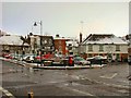
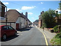
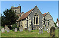
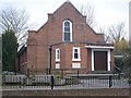
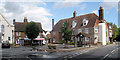
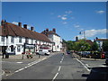
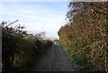
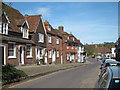
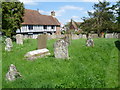
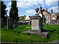
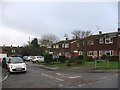
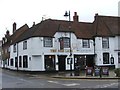
100 photos from this area
Area Information
Key information about the ME17 2PN including its size, population, and administrative classification.
- Area Type
- Postcode
- Area Size
- 1.5 hectares
- Population
- 1746
- Population Density
- 890 people/km²
House Prices in ME17 2PN
24
Properties
£408,542
Average Sold Price
£235,000
Lowest Price
£775,000
Highest Price
Showing 24 properties
| Address | Type | Beds | Baths | Last Sale Price | Last Sale Date | |
|---|---|---|---|---|---|---|
| 17 Faversham Road, Lenham, ME17 2PN | Detached | 3 | 1 | £355,000 | Dec 2025 | |
| 28 Faversham Road, Lenham, ME17 2PN | house | - | - | £775,000 | Apr 2025 | |
| 15 Faversham Road, Lenham, ME17 2PN | Semi-detached | 3 | 2 | £400,000 | Aug 2024 | |
| 11 Faversham Road, Lenham, ME17 2PN | house | - | - | £345,000 | Aug 2023 | |
| Little Butchers, 6 Faversham Road, Lenham, ME17 2PN | house | 2 | - | £240,000 | Aug 2019 | |
| Butchers Cottage, Faversham Road, Lenham, ME17 2PN | Semi-detached | 2 | 1 | £265,000 | Jul 2018 | |
| 5 Faversham Road, Lenham, ME17 2PN | house | - | - | £650,000 | Feb 2016 | |
| 22 Faversham Road, Lenham, ME17 2PN | Bungalow | - | - | £410,000 | Jul 2015 | |
| 20 Faversham Road, Lenham, ME17 2PN | Bungalow | 4 | - | £467,500 | Dec 2011 | |
| Pipers Wait, 9 Faversham Road, Lenham, ME17 2PN | Detached | 4 | 2 | £480,000 | Sep 2009 |
Page 1 of 3
Energy Efficiency in ME17 2PN
Amenities
Schools
| Rank | School | Type | Entry gender | Ages |
|---|
Explore more schools in this area
Go to Schools tabDemographics
Household Size
Two person
most common
Accommodation Type
Houses
most common
Tenure
73
majority
Ethnic Group
White
most common
Religion
N/A
most common
Household Composition
N/A
most common
Age
47
median
Adults (30-64 years)
most common
Household Deprivation
N/A
with no deprivation
NS-SEC
33
in Lower managerial occupations
Explore more demographic insights in this area
Go to Demographics tabPlanning
Planning Constraints
- Flood RiskPremium
- Ramsar Wetland SitesPremium
- Area of Outstanding Natural BeautyPremium
- Protected Nature ReservePremium
- Protected WoodlandPremium