Area Overview for ME17 2LL
Photos of ME17 2LL

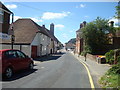


100 photos from this area
Area Information
Key information about the ME17 2LL including its size, population, and administrative classification.
- Area Type
- Postcode
- Area Size
- 6.2 hectares
- Population
- 1746
- Population Density
- 890 people/km²
House Prices in ME17 2LL
34
Properties
£308,450
Average Sold Price
£88,000
Lowest Price
£525,000
Highest Price
Showing 34 properties
| Address | Type | Beds | Baths | Last Sale Price | Last Sale Date | |
|---|---|---|---|---|---|---|
| 40 Ham Lane, Lenham, ME17 2LL | Detached | 3 | 1 | £400,000 | Jul 2025 | |
| 24 Ham Lane, Lenham, ME17 2LL | house | 3 | 2 | £425,000 | Feb 2025 | |
| 27 Ham Lane, Lenham, ME17 2LL | Detached | 4 | 2 | £500,000 | Sep 2024 | |
| 39 Ham Lane, Lenham, ME17 2LL | house | 3 | 2 | £475,000 | Jan 2024 | |
| 9 Ham Lane, Lenham, ME17 2LL | Detached | 4 | 2 | £525,000 | Mar 2023 | |
| 17 Ham Lane, Lenham, ME17 2LL | Detached | 4 | - | £505,000 | Jan 2023 | |
| 13 Ham Lane, Lenham, ME17 2LL | house | - | - | £355,000 | Nov 2020 | |
| 12 Ham Lane, Lenham, ME17 2LL | house | - | - | £350,000 | Mar 2020 | |
| 25 Ham Lane, Lenham, ME17 2LL | Detached | 4 | 2 | £400,000 | Nov 2019 | |
| 18 Ham Lane, Lenham, ME17 2LL | house | - | - | £410,000 | Dec 2016 |
Page 1 of 4
Energy Efficiency in ME17 2LL
Amenities
Schools
| Rank | School | Type | Entry gender | Ages |
|---|
Explore more schools in this area
Go to Schools tabDemographics
Household Size
Two person
most common
Accommodation Type
Houses
most common
Tenure
73
majority
Ethnic Group
White
most common
Religion
N/A
most common
Household Composition
N/A
most common
Age
47
median
Adults (30-64 years)
most common
Household Deprivation
N/A
with no deprivation
NS-SEC
33
in Lower managerial occupations
Explore more demographic insights in this area
Go to Demographics tabPlanning
Planning Constraints
- Flood RiskPremium
- Ramsar Wetland SitesPremium
- Area of Outstanding Natural BeautyPremium
- Protected Nature ReservePremium
- Protected WoodlandPremium