Area Overview for ME17 2BU
Photos of ME17 2BU
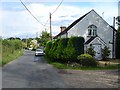
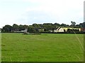
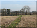
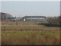


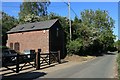
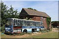
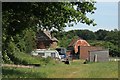
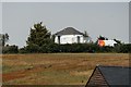
57 photos from this area
Area Information
Key information about the ME17 2BU including its size, population, and administrative classification.
- Area Type
- Postcode
- Area Size
- 8.4 hectares
- Population
- 1897
- Population Density
- 88 people/km²
House Prices in ME17 2BU
17
Properties
£334,393
Average Sold Price
£191,000
Lowest Price
£535,000
Highest Price
Showing 17 properties
| Address | Type | Beds | Baths | Last Sale Price | Last Sale Date | |
|---|---|---|---|---|---|---|
| Raysden, Lenham Heath Road, Lenham Heath, ME17 2BU | Retail | 3 | 2 | £535,000 | Sep 2021 | |
| Hazeline, Lenham Heath Road, Lenham Heath, ME17 2BU | Bungalow | - | - | £375,000 | Jan 2021 | |
| Lochnagar, Lenham Heath Road, Lenham Heath, ME17 2BU | Bungalow | - | - | £292,000 | Mar 2017 | |
| The Hawthorns, Lenham Heath Road, Lenham Heath, ME17 2BU | house | - | - | £237,750 | Dec 2009 | |
| The Conifers, Lenham Heath Road, Lenham Heath, ME17 2BU | Detached | - | - | £380,000 | May 2007 | |
| Magazine House, Lenham Heath Road, Charing, ME17 2BU | Detached | - | - | £330,000 | Nov 2005 | |
| Thornbury, Lenham Heath Road, Lenham Heath, ME17 2BU | house | - | - | £191,000 | Mar 2003 | |
| Fairview, Lenham Heath Road, Lenham Heath, ME17 2BU | Detached | 4 | 2 | - | - | |
| Lenham Oak, Lenham Heath Road, Charing, ME17 2BU | Industrial | - | - | - | - | |
| Fairview, Lenham Heath Road, Charing, ME17 2BU | Detached | - | - | - | - |
Page 1 of 2
Energy Efficiency in ME17 2BU
Amenities
Schools
| Rank | School | Type | Entry gender | Ages |
|---|
Explore more schools in this area
Go to Schools tabDemographics
Household Size
Two person
most common
Accommodation Type
Houses
most common
Tenure
79
majority
Ethnic Group
White
most common
Religion
N/A
most common
Household Composition
N/A
most common
Age
47
median
Adults (30-64 years)
most common
Household Deprivation
N/A
with no deprivation
NS-SEC
42
in Lower managerial occupations
Explore more demographic insights in this area
Go to Demographics tabPlanning
Planning Constraints
- Flood RiskPremium
- Ramsar Wetland SitesPremium
- Area of Outstanding Natural BeautyPremium
- Protected Nature ReservePremium
- Protected WoodlandPremium