Area Overview for ME17 1NP
Photos of ME17 1NP
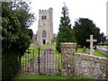
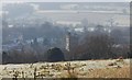
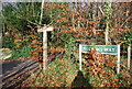
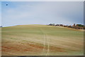
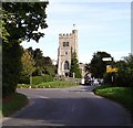
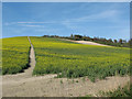
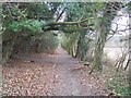
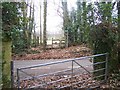

44 photos from this area
Area Information
Key information about the ME17 1NP including its size, population, and administrative classification.
- Area Type
- Postcode
- Area Size
- 26.4 hectares
- Population
- 1567
- Population Density
- 266 people/km²
House Prices in ME17 1NP
17
Properties
£760,899
Average Sold Price
£744,746
Lowest Price
£787,950
Highest Price
Showing 17 properties
| Address | Type | Beds | Baths | Last Sale Price | Last Sale Date | |
|---|---|---|---|---|---|---|
| The Tower House, Stede Hill, Harrietsham, ME17 1NP | house | - | - | £750,000 | May 2021 | |
| Pilgrims Court, Stede Hill, Harrietsham, ME17 1NP | Detached | 5 | 3 | £744,746 | Jul 2014 | |
| North Cottage, Stede Hill, Harrietsham, ME17 1NP | Detached | - | - | £787,950 | Nov 2007 | |
| The Adam Suite, Colesdane, Stede Hill, Harrietsham, ME17 1NP | Flat | 3 | 3 | - | - | |
| Walpole House, Colesdane, Stede Hill, Harrietsham, ME17 1NP | Detached | 4 | 3 | - | - | |
| The Vanbrugh Suite, Colesdane, Stede Hill, Harrietsham, ME17 1NP | Flat | 3 | 2 | - | - | |
| The Jefferson Suite, Colesdane, Stede Hill, Harrietsham, ME17 1NP | Retail | 3 | 2 | - | - | |
| The Nash Suite, Colesdane, Stede Hill, Harrietsham, ME17 1NP | Flat | 3 | 2 | - | - | |
| Pilgrims Lodge, Stede Hill, Harrietsham, ME17 1NP | Semi-detached | 4 | 3 | - | - | |
| Summoners Farm, Pilgrims Way, Harrietsham, ME17 1NP | Farm | - | - | - | - |
Page 1 of 2
Energy Efficiency in ME17 1NP
Amenities
Schools
| Rank | School | Type | Entry gender | Ages |
|---|
Explore more schools in this area
Go to Schools tabDemographics
Household Size
Two person
most common
Accommodation Type
Houses
most common
Tenure
83
majority
Ethnic Group
White
most common
Religion
N/A
most common
Household Composition
N/A
most common
Age
47
median
Adults (30-64 years)
most common
Household Deprivation
N/A
with no deprivation
NS-SEC
34
in Lower managerial occupations
Explore more demographic insights in this area
Go to Demographics tabPlanning
Planning Constraints
- Flood RiskPremium
- Ramsar Wetland SitesPremium
- Area of Outstanding Natural BeautyPremium
- Protected Nature ReservePremium
- Protected WoodlandPremium