Area Overview for ME17 1LH
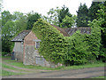
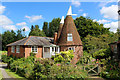
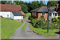
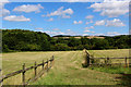
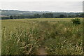
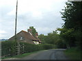
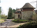
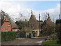
Photos of ME17 1LH


Area Information
ME17 1LH is a small residential postcode area in England, home to 1,876 people spread across a compact cluster with a population density of 429 people per square kilometre. This is a quiet, tightly knit community where daily life is shaped by proximity to local amenities and a mix of older and newer housing. The area’s character is defined by its modest scale, with most residents living in detached or semi-detached homes. Families and long-term residents dominate, reflected in the median age of 47 and the prevalence of adults aged 30–64. The area is served by nearby rail links, including Harrietsham and Lenham stations, offering easy access to surrounding towns. While it lacks major urban hubs, its small size means residents can walk or cycle to local shops, schools, and community spaces. The presence of Harrietsham Church of England Primary School, rated good by Ofsted, adds to the appeal for families. For those seeking a peaceful, low-density lifestyle with practical connectivity, ME17 1LH offers a balance of convenience and tranquillity.
- Area Type
- Postcode
- Area Size
- Not available
- Population
- 1876
- Population Density
- 429 people/km²
ME17 1LH is a predominantly owner-occupied area, with 77% of properties owned by residents rather than rented. The housing stock is largely composed of houses, not flats, indicating a focus on single-family homes. This suggests a market that caters to households seeking space and privacy, rather than high-density living. The small size of the postcode area means the property selection is limited, though nearby towns may offer more options for buyers looking to expand their search. The high home ownership rate implies a stable market with long-term residents, which can be appealing for those seeking a settled community. However, the lack of rental properties may limit flexibility for those needing short-term housing. For buyers, this area is ideal for those prioritising a quiet, family-friendly environment with established homes, though the limited local supply means competition could be strong.
House Prices in ME17 1LH
No properties found in this postcode.
Energy Efficiency in ME17 1LH
Living in ME17 1LH offers access to essential amenities within walking or short driving distance. The retail sector includes Co-op Harrietsham, M&S Lenham BP SF, and Morrisons Daily, providing everyday shopping needs. These stores cater to daily essentials, though the selection is modest compared to larger towns. For transport, three railway stations—Harrietsham, Lenham, and Hollingbourne—offer connections to surrounding areas, making it easier to access broader services. While the area lacks expansive parks or leisure facilities, the compact layout ensures convenience. The presence of a primary school and nearby retail options contributes to a self-contained lifestyle, ideal for those prioritising simplicity and ease of access. However, residents may need to travel further for specialist services, reflecting the area’s small-scale nature.
Amenities
Schools
The nearest school to ME17 1LH is Harrietsham Church of England Primary School, which serves children aged 4–11. Rated good by Ofsted, it provides a solid foundation for early education. The absence of secondary schools in the immediate area means families may need to look to nearby towns for secondary education, such as those served by Lenham or Hollingbourne railway stations. The presence of a well-rated primary school is a key draw for families, offering a reliable local option for younger children. However, the limited range of educational institutions reflects the area’s small scale. Parents should consider the need for additional transport or relocation for older children, but the primary school’s quality ensures a strong start for local students.
| Rank | School | Type | Entry gender | Ages |
|---|
Explore more schools in this area
Go to Schools tabDemographics
The community in ME17 1LH is predominantly middle-aged, with a median age of 47 and the majority of residents falling within the 30–64 age range. This suggests a stable population with established households, many of whom are homeowners—77% of properties are owner-occupied. The area is largely composed of houses, not flats, reflecting a preference for single-family dwellings. The predominant ethnic group is White, though specific data on diversity or deprivation is not provided. The age profile indicates a mature demographic, which may influence local services and amenities. With 77% home ownership, the area is not heavily reliant on rental markets, suggesting a long-term commitment from residents. The absence of detailed diversity statistics means the full range of community experiences is not quantified, but the data highlights a cohesive, settled population focused on residential stability.
Household Size
Accommodation Type
Tenure
Ethnic Group
Religion
Household Composition
Age
Household Deprivation
NS-SEC
Explore more demographic insights in this area
Go to Demographics tabPlanning
Planning Constraints
- Flood RiskPremium
- Ramsar Wetland SitesPremium
- Area of Outstanding Natural BeautyPremium
- Protected Nature ReservePremium
- Protected WoodlandPremium