Area Overview for ME17 1AR
Photos of ME17 1AR
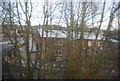

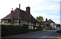


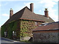
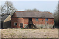
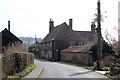
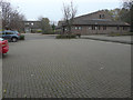
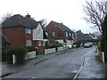
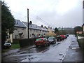

44 photos from this area
Area Information
Key information about the ME17 1AR including its size, population, and administrative classification.
- Area Type
- Postcode
- Area Size
- 2.6 hectares
- Population
- 1567
- Population Density
- 266 people/km²
House Prices in ME17 1AR
13
Properties
£426,000
Average Sold Price
£194,000
Lowest Price
£525,000
Highest Price
Showing 13 properties
| Address | Type | Beds | Baths | Last Sale Price | Last Sale Date | |
|---|---|---|---|---|---|---|
| Downside, Lakelands, Harrietsham, ME17 1AR | house | - | - | £525,000 | Jun 2023 | |
| High Elms, Lakelands, Harrietsham, ME17 1AR | Bungalow | 4 | 2 | £400,000 | Jun 2020 | |
| Felicita, Lakelands, Harrietsham, ME17 1AR | Bungalow | 3 | 1 | £448,000 | Nov 2017 | |
| Scarletts, Lakelands, Harrietsham, ME17 1AR | Detached | 4 | - | £466,000 | Apr 2010 | |
| Durham Lodge, Lakelands, Harrietsham, ME17 1AR | Detached | - | - | £479,000 | Jul 2007 | |
| The Goldings, Lakelands, Harrietsham, ME17 1AR | Detached | - | - | £470,000 | Jun 2007 | |
| Woodcote House, Lakelands, Harrietsham, ME17 1AR | Semi-detached | - | - | £194,000 | Feb 1998 | |
| Carisbrooke, Lakelands, Harrietsham, ME17 1AR | Detached | 3 | 1 | - | - | |
| Annandale, Lakelands, Harrietsham, ME17 1AR | Detached | - | - | - | - | |
| Mickleden, Lakelands, Harrietsham, ME17 1AR | Detached | - | - | - | - |
Page 1 of 2
Energy Efficiency in ME17 1AR
Amenities
Schools
| Rank | School | Type | Entry gender | Ages |
|---|
Explore more schools in this area
Go to Schools tabDemographics
Household Size
Two person
most common
Accommodation Type
Houses
most common
Tenure
83
majority
Ethnic Group
White
most common
Religion
N/A
most common
Household Composition
N/A
most common
Age
47
median
Adults (30-64 years)
most common
Household Deprivation
N/A
with no deprivation
NS-SEC
34
in Lower managerial occupations
Explore more demographic insights in this area
Go to Demographics tabPlanning
Planning Constraints
- Flood RiskPremium
- Ramsar Wetland SitesPremium
- Area of Outstanding Natural BeautyPremium
- Protected Nature ReservePremium
- Protected WoodlandPremium