Area Overview for ME16 8PP
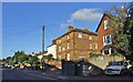
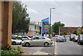
Photos of ME16 8PP


Area Information
Living in ME16 8PP means inhabiting a compact, residential cluster in England’s southeast, where 2,276 people reside across 926 square metres. This high population density creates a tightly knit community, with homes primarily in single-family structures. The area’s proximity to rail networks and retail hubs like Asda Living and Lidl St ensures daily convenience, while its small size fosters a sense of familiarity. The median age of 47 suggests a mature demographic, with many residents in their 30s to 60s. While the area lacks natural reserves or protected landscapes, its practical connectivity to Maidstone and Rochester makes it a viable choice for commuters. The absence of flood risks or planning constraints adds to its appeal, though crime rates sit at an average level. For buyers seeking a manageable, well-serviced environment, ME16 8PP offers a blend of accessibility and simplicity, albeit with a focus on practicality over scenic grandeur.
- Area Type
- Postcode
- Area Size
- 926 m²
- Population
- 2276
- Population Density
- 6702 people/km²
ME16 8PP’s property market is characterised by a 43% home ownership rate, indicating that over half of properties are rented. This suggests a mix of owner-occupied and rental homes, with the latter possibly catering to commuters or temporary residents. The accommodation type is predominantly houses, which are more common than flats or apartments in this small area. Given the high population density and limited land area, the housing stock is likely constrained, with little scope for new developments. For buyers, this means a limited selection of properties, often focused on existing homes rather than new builds. The area’s proximity to rail links may attract those seeking easy access to nearby towns, but the small size of ME16 8PP means buyers should consider nearby areas for more options.
House Prices in ME16 8PP
No properties found in this postcode.
Energy Efficiency in ME16 8PP
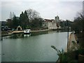
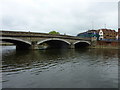
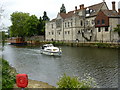
Daily life in ME16 8PP is shaped by its proximity to essential amenities. Retail options include Asda Living, Lidl St, and Spar, providing access to groceries and everyday essentials. The five nearby railway stations—Maidstone West, Maidstone Barracks, and Maidstone East—offer frequent services, connecting residents to larger towns and cities. While the area lacks detailed information on parks or leisure facilities, its compact size ensures that shops, transport, and the nearby Rochester Airport are all within easy reach. This practical accessibility supports a lifestyle focused on convenience, with minimal need for long commutes. The presence of multiple rail links also enhances mobility, making it easier for residents to balance local living with opportunities beyond the immediate area.
Amenities
Schools
| Rank | School | Type | Entry gender | Ages |
|---|
Explore more schools in this area
Go to Schools tabDemographics
ME16 8PP’s population skews toward adults aged 30–64, with a median age of 47. This suggests a community of established professionals and families, rather than a student or retirement demographic. Home ownership stands at 43%, meaning nearly half of residents rent, which may indicate a mix of long-term occupants and transient workers. The area’s accommodation is predominantly houses, reflecting a preference for single-family living over flats or apartments. The predominant ethnic group is White, with no data provided on other demographics. The population density of 2.46 million people per square kilometre is exceptionally high, which may influence local infrastructure and social dynamics. While no specific deprivation data is available, the age profile and housing stock suggest a stable, if somewhat aging, community.
Household Size
Accommodation Type
Tenure
Ethnic Group
Religion
Household Composition
Age
Household Deprivation
NS-SEC
Explore more demographic insights in this area
Go to Demographics tabPlanning
Planning Constraints
- Flood RiskPremium
- Ramsar Wetland SitesPremium
- Area of Outstanding Natural BeautyPremium
- Protected Nature ReservePremium
- Protected WoodlandPremium