Area Overview for ME16 8BT
Photos of ME16 8BT
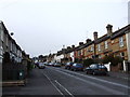
54 photos from this area
Area Information
Key information about the ME16 8BT including its size, population, and administrative classification.
- Area Type
- Postcode
- Area Size
- 1.6 hectares
- Population
- 1791
- Population Density
- 7541 people/km²
House Prices in ME16 8BT
42
Properties
£230,825
Average Sold Price
£60,000
Lowest Price
£500,000
Highest Price
Showing 42 properties
| Address | Type | Beds | Baths | Last Sale Price | Last Sale Date | |
|---|---|---|---|---|---|---|
| 155 Upper Fant Road, Maidstone, ME16 8BT | house | 3 | 1 | £500,000 | Sep 2025 | |
| 171 Upper Fant Road, Maidstone, ME16 8BT | Terraced | 3 | 1 | £287,000 | Feb 2023 | |
| 85 Upper Fant Road, Maidstone, ME16 8BT | house | - | - | £460,000 | Dec 2022 | |
| 173 Upper Fant Road, Maidstone, ME16 8BT | Terraced | 2 | - | £252,500 | Jun 2022 | |
| 73 Upper Fant Road, Maidstone, ME16 8BT | house | 3 | 1 | £360,000 | Jun 2021 | |
| 151 Upper Fant Road, Maidstone, ME16 8BT | Semi-detached | 3 | - | £330,000 | Feb 2021 | |
| 111 Upper Fant Road, Maidstone, ME16 8BT | house | 3 | - | £320,000 | Nov 2020 | |
| 157 Upper Fant Road, Maidstone, ME16 8BT | Terraced | 2 | 1 | £250,505 | Aug 2020 | |
| 133 Upper Fant Road, Maidstone, ME16 8BT | house | - | - | £275,000 | Jul 2020 | |
| 137 Upper Fant Road, Maidstone, ME16 8BT | Semi-detached | 3 | 1 | £253,000 | Dec 2019 |
Page 1 of 5
Energy Efficiency in ME16 8BT
Amenities
Schools
| Rank | School | Type | Entry gender | Ages |
|---|
Explore more schools in this area
Go to Schools tabDemographics
Household Size
Family (3-5 people)
most common
Accommodation Type
Houses
most common
Tenure
55
majority
Ethnic Group
White
most common
Religion
N/A
most common
Household Composition
N/A
most common
Age
47
median
Adults (30-64 years)
most common
Household Deprivation
N/A
with no deprivation
NS-SEC
31
in Lower managerial occupations
Explore more demographic insights in this area
Go to Demographics tabPlanning
Planning Constraints
- Flood RiskPremium
- Ramsar Wetland SitesPremium
- Area of Outstanding Natural BeautyPremium
- Protected Nature ReservePremium
- Protected WoodlandPremium