Area Overview for ME16 0WT
Photos of ME16 0WT
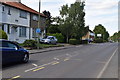
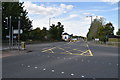
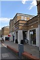
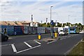
46 photos from this area
Area Information
Key information about the ME16 0WT including its size, population, and administrative classification.
- Area Type
- Postcode
- Area Size
- 4.8 hectares
- Population
- 2331
- Population Density
- 3777 people/km²
House Prices in ME16 0WT
14
Properties
£303,493
Average Sold Price
£137,000
Lowest Price
£757,500
Highest Price
Showing 14 properties
| Address | Type | Beds | Baths | Last Sale Price | Last Sale Date | |
|---|---|---|---|---|---|---|
| 21 Denning Close, Maidstone, ME16 0WT | Detached | 4 | 4 | £757,500 | Jan 2025 | |
| 9 Denning Close, Maidstone, ME16 0WT | house | 3 | 2 | £385,000 | Nov 2022 | |
| 7 Denning Close, Maidstone, ME16 0WT | Terraced | 3 | 2 | £285,000 | Oct 2020 | |
| 17 Denning Close, Maidstone, ME16 0WT | Terraced | 3 | 2 | £280,000 | Feb 2020 | |
| 25 Denning Close, Maidstone, ME16 0WT | house | 5 | 3 | £467,500 | Oct 2014 | |
| 5 Denning Close, Maidstone, ME16 0WT | house | 3 | 1 | £185,000 | Aug 2012 | |
| 1 Denning Close, Maidstone, ME16 0WT | Terraced | 3 | 2 | £201,000 | Jun 2006 | |
| 3 Denning Close, Maidstone, ME16 0WT | Terraced | - | - | £169,950 | Mar 2004 | |
| 15 Denning Close, Maidstone, ME16 0WT | Terraced | - | - | £137,000 | Feb 2004 | |
| 11 Denning Close, Maidstone, ME16 0WT | Terraced | 2 | 1 | £150,000 | Jan 2004 |
Page 1 of 2
Energy Efficiency in ME16 0WT
Amenities
Schools
| Rank | School | Type | Entry gender | Ages |
|---|
Explore more schools in this area
Go to Schools tabDemographics
Household Size
Family (3-5 people)
most common
Accommodation Type
Houses
most common
Tenure
68
majority
Ethnic Group
White
most common
Religion
N/A
most common
Household Composition
N/A
most common
Age
47
median
Adults (30-64 years)
most common
Household Deprivation
N/A
with no deprivation
NS-SEC
45
in Lower managerial occupations
Explore more demographic insights in this area
Go to Demographics tabPlanning
Planning Constraints
- Flood RiskPremium
- Ramsar Wetland SitesPremium
- Area of Outstanding Natural BeautyPremium
- Protected Nature ReservePremium
- Protected WoodlandPremium