Area Overview for ME16 0QY
Photos of ME16 0QY

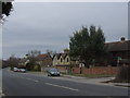
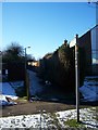
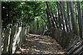
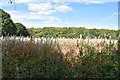
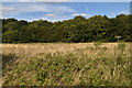
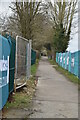
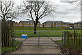
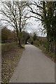
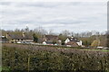
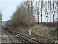
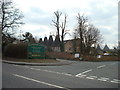
49 photos from this area
Area Information
Key information about the ME16 0QY including its size, population, and administrative classification.
- Area Type
- Postcode
- Area Size
- 8052 m²
- Population
- 1695
- Population Density
- 4034 people/km²
House Prices in ME16 0QY
20
Properties
£301,687
Average Sold Price
£74,800
Lowest Price
£439,500
Highest Price
Showing 20 properties
| Address | Type | Beds | Baths | Last Sale Price | Last Sale Date | |
|---|---|---|---|---|---|---|
| 47 Maxwell Drive, Maidstone, ME16 0QY | Semi-detached | 3 | 3 | £439,500 | Nov 2025 | |
| 49 Maxwell Drive, Maidstone, ME16 0QY | Detached | 2 | 1 | £375,000 | Sep 2025 | |
| 57 Maxwell Drive, Maidstone, ME16 0QY | house | - | - | £375,000 | Dec 2024 | |
| 55 Maxwell Drive, Maidstone, ME16 0QY | Semi-detached | 2 | 1 | £270,000 | Aug 2023 | |
| 51 Maxwell Drive, Maidstone, ME16 0QY | Bungalow | - | - | £316,000 | Dec 2021 | |
| 53 Maxwell Drive, Maidstone, ME16 0QY | Bungalow | - | - | £335,000 | Aug 2021 | |
| 35 Maxwell Drive, Maidstone, ME16 0QY | Bungalow | - | - | £375,000 | Jun 2019 | |
| 65 Maxwell Drive, Maidstone, ME16 0QY | Detached | 4 | 2 | £390,000 | Jul 2018 | |
| 43 Maxwell Drive, Maidstone, ME16 0QY | Bungalow | - | - | £295,000 | Jan 2018 | |
| 61 Maxwell Drive, Maidstone, ME16 0QY | Bungalow | 3 | 1 | £335,000 | Nov 2016 |
Page 1 of 2
Energy Efficiency in ME16 0QY
Amenities
Schools
| Rank | School | Type | Entry gender | Ages |
|---|
Explore more schools in this area
Go to Schools tabDemographics
Household Size
Two person
most common
Accommodation Type
Houses
most common
Tenure
93
majority
Ethnic Group
White
most common
Religion
N/A
most common
Household Composition
N/A
most common
Age
47
median
Adults (30-64 years)
most common
Household Deprivation
N/A
with no deprivation
NS-SEC
41
in Lower managerial occupations
Explore more demographic insights in this area
Go to Demographics tabPlanning
Planning Constraints
- Flood RiskPremium
- Ramsar Wetland SitesPremium
- Area of Outstanding Natural BeautyPremium
- Protected Nature ReservePremium
- Protected WoodlandPremium