Area Overview for ME15 9ZL
Photos of ME15 9ZL
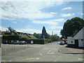
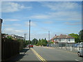
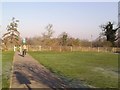
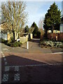
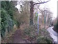

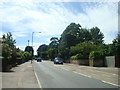
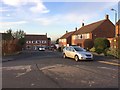
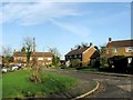
60 photos from this area
Area Information
Key information about the ME15 9ZL including its size, population, and administrative classification.
- Area Type
- Postcode
- Area Size
- 1.2 hectares
- Population
- 2740
- Population Density
- 4714 people/km²
House Prices in ME15 9ZL
48
Properties
£151,857
Average Sold Price
£38,750
Lowest Price
£328,000
Highest Price
Showing 48 properties
| Address | Type | Beds | Baths | Last Sale Price | Last Sale Date | |
|---|---|---|---|---|---|---|
| 10 Hawkes Way, Maidstone, ME15 9ZL | Flat | - | - | £205,000 | Aug 2024 | |
| 33 Hawkes Way, Maidstone, ME15 9ZL | Flat | - | - | £43,750 | Aug 2022 | |
| 9 Hawkes Way, Maidstone, ME15 9ZL | Flat | - | - | £202,000 | Jan 2022 | |
| 6 Hawkes Way, Maidstone, ME15 9ZL | Flat | - | - | £202,500 | Jan 2022 | |
| 21 Hawkes Way, Maidstone, ME15 9ZL | Flat | - | - | £61,250 | Aug 2021 | |
| 47 Hawkes Way, Maidstone, ME15 9ZL | Detached | 3 | 1 | £328,000 | Sep 2019 | |
| 48 Hawkes Way, Maidstone, ME15 9ZL | Maisonette | - | - | £216,000 | Aug 2018 | |
| 5 Hawkes Way, Maidstone, ME15 9ZL | Flat | - | - | £195,000 | Feb 2017 | |
| 23 Hawkes Way, Maidstone, ME15 9ZL | Flat | 2 | 1 | £59,500 | Nov 2016 | |
| 20 Hawkes Way, Maidstone, ME15 9ZL | Flat | - | - | £41,250 | Oct 2016 |
Page 1 of 5
Energy Efficiency in ME15 9ZL
Amenities
Schools
| Rank | School | Type | Entry gender | Ages |
|---|
Explore more schools in this area
Go to Schools tabDemographics
Household Size
Family (3-5 people)
most common
Accommodation Type
Houses
most common
Tenure
70
majority
Ethnic Group
White
most common
Religion
N/A
most common
Household Composition
N/A
most common
Age
47
median
Adults (30-64 years)
most common
Household Deprivation
N/A
with no deprivation
NS-SEC
34
in Lower managerial occupations
Explore more demographic insights in this area
Go to Demographics tabPlanning
Planning Constraints
- Flood RiskPremium
- Ramsar Wetland SitesPremium
- Area of Outstanding Natural BeautyPremium
- Protected Nature ReservePremium
- Protected WoodlandPremium