Area Overview for ME15 9ST
Photos of ME15 9ST
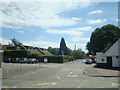
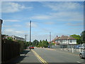
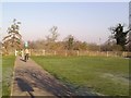
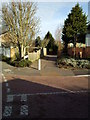
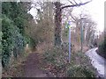

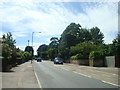
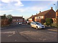
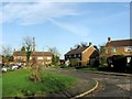
60 photos from this area
Area Information
Key information about the ME15 9ST including its size, population, and administrative classification.
- Area Type
- Postcode
- Area Size
- 7434 m²
- Population
- 1537
- Population Density
- 1042 people/km²
House Prices in ME15 9ST
23
Properties
£244,863
Average Sold Price
£75,000
Lowest Price
£425,000
Highest Price
Showing 23 properties
| Address | Type | Beds | Baths | Last Sale Price | Last Sale Date | |
|---|---|---|---|---|---|---|
| 1 Staffa Road, Maidstone, ME15 9ST | Semi-detached | 3 | 2 | £392,500 | Jul 2023 | |
| 3 Staffa Road, Maidstone, ME15 9ST | Retail | 3 | 1 | £380,000 | Jul 2022 | |
| 9 Staffa Road, Maidstone, ME15 9ST | house | - | - | £340,000 | Oct 2021 | |
| 19 Staffa Road, Maidstone, ME15 9ST | house | - | - | £425,000 | Jul 2016 | |
| 10 Staffa Road, Maidstone, ME15 9ST | Semi-detached | 4 | 2 | £305,000 | Feb 2016 | |
| 14 Staffa Road, Maidstone, ME15 9ST | house | - | - | £192,000 | Oct 2013 | |
| 11 Staffa Road, Maidstone, ME15 9ST | house | - | - | £245,000 | Sep 2013 | |
| 13 Staffa Road, Maidstone, ME15 9ST | Semi-detached | 4 | 2 | £198,000 | Aug 2010 | |
| 15 Staffa Road, Maidstone, ME15 9ST | Semi-detached | 3 | 1 | £218,000 | Sep 2009 | |
| 6 Staffa Road, Maidstone, ME15 9ST | house | - | - | £175,000 | Oct 2008 |
Page 1 of 3
Energy Efficiency in ME15 9ST
Amenities
Schools
| Rank | School | Type | Entry gender | Ages |
|---|
Explore more schools in this area
Go to Schools tabDemographics
Household Size
Two person
most common
Accommodation Type
Houses
most common
Tenure
91
majority
Ethnic Group
White
most common
Religion
N/A
most common
Household Composition
N/A
most common
Age
47
median
Adults (30-64 years)
most common
Household Deprivation
N/A
with no deprivation
NS-SEC
47
in Lower managerial occupations
Explore more demographic insights in this area
Go to Demographics tabPlanning
Planning Constraints
- Flood RiskPremium
- Ramsar Wetland SitesPremium
- Area of Outstanding Natural BeautyPremium
- Protected Nature ReservePremium
- Protected WoodlandPremium