Area Overview for ME15 9RL
Photos of ME15 9RL


Area Information
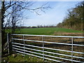
ME15 9RL is a small, tightly knit residential postcode area in England, home to 1506 residents. It sits within a compact cluster of properties, offering a quiet, low-density living environment. The area’s demographic profile suggests a mature community, with a median age of 47 and a strong presence of adults aged 30–64. This suggests a mix of established families and long-term residents, contributing to a stable, familiar atmosphere. The area’s proximity to rail networks and retail hubs like Morrisons Shepway and Co-op Maidstone ensures practical access to daily essentials. With a population of just over 1,500, ME15 9RL is not a sprawling suburb but a focused neighbourhood where local amenities and transport links are within easy reach. The broadband score of 94 and mobile coverage of 84 indicate reliable digital connectivity, supporting both remote work and everyday internet use. While the area lacks natural constraints like protected woodlands or wetlands, its safety profile includes a low flood risk and medium crime risk, which residents should consider alongside the area’s practical advantages.
- Area Type
- Postcode
- Area Size
- Not available
- Population
- 1506
- Population Density
- 3706 people/km²
The property market in ME15 9RL is characterised by a high rate of home ownership (69%) and a focus on houses rather than flats or apartments. This suggests a market skewed towards owner-occupied homes, likely with a mix of semi-detached and detached properties given the area’s small size. The limited population and compact nature of the postcode imply a constrained housing stock, which could make the area appealing for buyers seeking a quieter, less congested environment. However, the lack of specific data on property prices or rental rates means the market’s dynamics remain partially opaque. For buyers, the emphasis on owner-occupation indicates a community where long-term residency is common, potentially offering a sense of continuity. The absence of large-scale development or rental-focused schemes suggests a stable, low-turnover market, though the small size of the area may limit options for those seeking a wide range of properties.
House Prices in ME15 9RL
No properties found in this postcode.
Energy Efficiency in ME15 9RL
The lifestyle in ME15 9RL is shaped by its proximity to retail and transport hubs. Nearby, residents can access Morrisons Shepway and two Co-op stores in Maidstone, providing essential shopping and grocery needs. The area’s rail network, with five stations including Maidstone West and East, offers convenient access to public transport, enabling easy travel to larger towns for work, leisure, or socialising. While the data does not mention parks or recreational spaces, the lack of planning constraints like protected woodlands or nature reserves suggests the area is free from environmental restrictions that might limit development or outdoor activities. The combination of retail access and rail connectivity creates a practical, commuter-friendly lifestyle, ideal for those balancing local convenience with regional opportunities. The absence of specific data on dining or leisure venues means these aspects remain unexplored, but the existing amenities indicate a functional, service-oriented environment.
Amenities
Schools
| Rank | School | Type | Entry gender | Ages |
|---|
Explore more schools in this area
Go to Schools tabDemographics
ME15 9RL is predominantly inhabited by adults aged 30–64, with a median age of 47. This suggests a community of middle-aged individuals, likely including families and professionals in their prime working years. Home ownership is high, with 69% of properties occupied by owners, indicating a stable housing market and long-term residency. The accommodation type is primarily houses, reflecting a preference for single-family homes over flats or apartments. The predominant ethnic group is White, which aligns with broader trends in the region. While no data on deprivation or diversity beyond ethnicity is provided, the age and ownership profile suggests a community focused on stability and family-oriented living. The absence of specific data on household types or income levels means these aspects remain unexplored, but the existing figures paint a picture of a settled, mature demographic.
Household Size
Accommodation Type
Tenure
Ethnic Group
Religion
Household Composition
Age
Household Deprivation
NS-SEC
Explore more demographic insights in this area
Go to Demographics tabPlanning
Planning Constraints
- Flood RiskPremium
- Ramsar Wetland SitesPremium
- Area of Outstanding Natural BeautyPremium
- Protected Nature ReservePremium
- Protected WoodlandPremium
- Crime RiskPremium