Area Overview for ME15 8RY
Photos of ME15 8RY
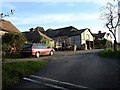
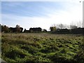
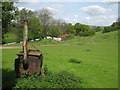
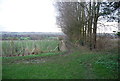
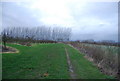
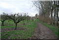
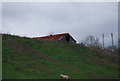
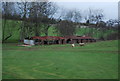
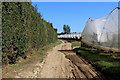
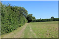

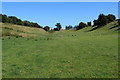
67 photos from this area
Area Information
Key information about the ME15 8RY including its size, population, and administrative classification.
- Area Type
- Postcode
- Area Size
- 44.7 hectares
- Population
- 2049
- Population Density
- 580 people/km²
House Prices in ME15 8RY
20
Properties
£742,700
Average Sold Price
£390,000
Lowest Price
£1,100,000
Highest Price
Showing 20 properties
| Address | Type | Beds | Baths | Last Sale Price | Last Sale Date | |
|---|---|---|---|---|---|---|
| Holly Farm Oast, Holly Farm Road, Otham, ME15 8RY | Detached | 5 | 3 | £1,075,000 | Aug 2024 | |
| Holly Farm House, Holly Farm Road, Otham, ME15 8RY | Detached | 5 | 4 | £1,100,000 | Oct 2022 | |
| Holly Farm Barn, Holly Farm Road, Otham, ME15 8RY | Semi-detached | 4 | 2 | £490,000 | Oct 2019 | |
| The Granary, Holly Farm Road, Otham, ME15 8RY | house | 4 | - | £658,500 | Nov 2017 | |
| The Old Barn, Holly Farm Road, Otham, ME15 8RY | Detached | - | - | £390,000 | Jul 2006 | |
| Holly Farm, Holly Farm Road, Otham, ME15 8RY | Semi-detached | 4 | 2 | - | - | |
| Building O, Holly Farm, Holly Farm Road, Otham, ME15 8RY | Industrial | - | - | - | - | |
| Tennis 48M From Granville House, Holly Farm Road 67M From Holly Farm Road, Holly Farm Road, Otham, ME15 8RY | Leisure | - | - | - | - | |
| Tennis 36M From Ridings, Holly Farm Road 32M From Holly Farm Road, Holly Farm Road, Otham, ME15 8RY | Leisure | - | - | - | - | |
| A F Sage And Sons, Highwood Farm Packing Sheds, Holly Farm Road, Otham, ME15 8RY | Farm | - | - | - | - |
Page 1 of 2
Energy Efficiency in ME15 8RY
Amenities
Schools
| Rank | School | Type | Entry gender | Ages |
|---|
Explore more schools in this area
Go to Schools tabDemographics
Household Size
Family (3-5 people)
most common
Accommodation Type
Houses
most common
Tenure
77
majority
Ethnic Group
White
most common
Religion
N/A
most common
Household Composition
N/A
most common
Age
47
median
Adults (30-64 years)
most common
Household Deprivation
N/A
with no deprivation
NS-SEC
41
in Lower managerial occupations
Explore more demographic insights in this area
Go to Demographics tabPlanning
Planning Constraints
- Flood RiskPremium
- Ramsar Wetland SitesPremium
- Area of Outstanding Natural BeautyPremium
- Protected Nature ReservePremium
- Protected WoodlandPremium