Area Overview for ME15 8QP
Photos of ME15 8QP
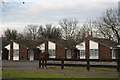
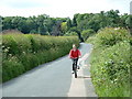
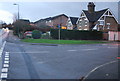
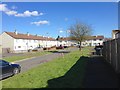
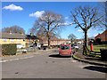
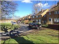
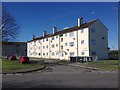
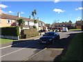
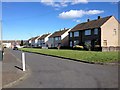
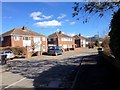
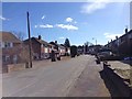
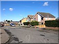
47 photos from this area
Area Information
Key information about the ME15 8QP including its size, population, and administrative classification.
- Area Type
- Postcode
- Area Size
- 5100 m²
- Population
- 1332
- Population Density
- 5661 people/km²
House Prices in ME15 8QP
21
Properties
£210,188
Average Sold Price
£162,500
Lowest Price
£315,000
Highest Price
Showing 21 properties
| Address | Type | Beds | Baths | Last Sale Price | Last Sale Date | |
|---|---|---|---|---|---|---|
| 33 Reculver Walk, Maidstone, ME15 8QP | Terraced | - | - | £200,000 | Sep 2023 | |
| 59 Reculver Walk, Maidstone, ME15 8QP | Terraced | 4 | 1 | £315,000 | Mar 2022 | |
| 49 Reculver Walk, Maidstone, ME15 8QP | house | 4 | 1 | £199,000 | Mar 2021 | |
| 51 Reculver Walk, Maidstone, ME15 8QP | house | - | - | £275,000 | Mar 2021 | |
| 61 Reculver Walk, Maidstone, ME15 8QP | Terraced | 4 | 2 | £268,000 | Jan 2020 | |
| 37 Reculver Walk, Maidstone, ME15 8QP | Terraced | 2 | 1 | £220,000 | Sep 2017 | |
| 39 Reculver Walk, Maidstone, ME15 8QP | house | - | - | £262,000 | May 2017 | |
| 29 Reculver Walk, Maidstone, ME15 8QP | house | - | - | £165,000 | May 2015 | |
| 31 Reculver Walk, Maidstone, ME15 8QP | Terraced | 2 | 1 | £165,000 | Nov 2014 | |
| 53 Reculver Walk, Maidstone, ME15 8QP | Terraced | 4 | 2 | £164,950 | Jan 2011 |
Page 1 of 3
Energy Efficiency in ME15 8QP
Amenities
Schools
| Rank | School | Type | Entry gender | Ages |
|---|
Explore more schools in this area
Go to Schools tabDemographics
Household Size
One person
most common
Accommodation Type
Houses
most common
Tenure
47
majority
Ethnic Group
White
most common
Religion
N/A
most common
Household Composition
N/A
most common
Age
47
median
Adults (30-64 years)
most common
Household Deprivation
N/A
with no deprivation
NS-SEC
18
in Lower managerial occupations
Explore more demographic insights in this area
Go to Demographics tabPlanning
Planning Constraints
- Flood RiskPremium
- Ramsar Wetland SitesPremium
- Area of Outstanding Natural BeautyPremium
- Protected Nature ReservePremium
- Protected WoodlandPremium