Area Overview for ME15 8PN
Photos of ME15 8PN
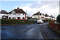
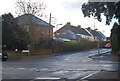
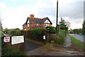
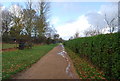
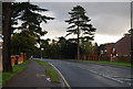
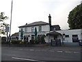

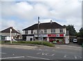
73 photos from this area
Area Information
Key information about the ME15 8PN including its size, population, and administrative classification.
- Area Type
- Postcode
- Area Size
- 5781 m²
- Population
- 1555
- Population Density
- 1811 people/km²
House Prices in ME15 8PN
13
Properties
£388,150
Average Sold Price
£75,000
Lowest Price
£690,000
Highest Price
Showing 13 properties
| Address | Type | Beds | Baths | Last Sale Price | Last Sale Date | |
|---|---|---|---|---|---|---|
| 13 Cavendish Way, Bearsted, ME15 8PN | Detached | 4 | 2 | £690,000 | Apr 2025 | |
| 14 Cavendish Way, Bearsted, ME15 8PN | Detached | 4 | 1 | £475,000 | Jun 2024 | |
| 23 Cavendish Way, Bearsted, ME15 8PN | Semi-detached | 3 | 2 | £380,000 | Mar 2024 | |
| 20 Cavendish Way, Bearsted, ME15 8PN | Retail | 4 | 2 | £540,000 | Nov 2022 | |
| 9 Cavendish Way, Bearsted, ME15 8PN | Bungalow | - | - | £470,000 | Feb 2021 | |
| 21 Cavendish Way, Bearsted, ME15 8PN | Bungalow | 3 | 1 | £470,000 | Jul 2019 | |
| 19 Cavendish Way, Bearsted, ME15 8PN | Bungalow | - | - | £437,500 | Oct 2016 | |
| 15 Cavendish Way, Bearsted, ME15 8PN | Bungalow | 2 | - | £189,000 | Jul 2010 | |
| 12 Cavendish Way, Bearsted, ME15 8PN | Detached | 4 | 2 | £155,000 | Nov 1999 | |
| 17 Cavendish Way, Bearsted, ME15 8PN | Bungalow | 2 | - | £75,000 | Apr 1999 |
Page 1 of 2
Energy Efficiency in ME15 8PN
Amenities
Schools
| Rank | School | Type | Entry gender | Ages |
|---|
Explore more schools in this area
Go to Schools tabDemographics
Household Size
Two person
most common
Accommodation Type
Houses
most common
Tenure
90
majority
Ethnic Group
White
most common
Religion
N/A
most common
Household Composition
N/A
most common
Age
47
median
Adults (30-64 years)
most common
Household Deprivation
N/A
with no deprivation
NS-SEC
45
in Lower managerial occupations
Explore more demographic insights in this area
Go to Demographics tabPlanning
Planning Constraints
- Flood RiskPremium
- Ramsar Wetland SitesPremium
- Area of Outstanding Natural BeautyPremium
- Protected Nature ReservePremium
- Protected WoodlandPremium