Area Overview for ME15 8PH
Photos of ME15 8PH
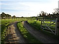
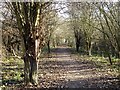
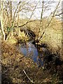
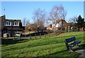
46 photos from this area
Area Information
Key information about the ME15 8PH including its size, population, and administrative classification.
- Area Type
- Postcode
- Area Size
- 1.9 hectares
- Population
- 1555
- Population Density
- 1811 people/km²
House Prices in ME15 8PH
31
Properties
£342,700
Average Sold Price
£72,048
Lowest Price
£600,000
Highest Price
Showing 31 properties
| Address | Type | Beds | Baths | Last Sale Price | Last Sale Date | |
|---|---|---|---|---|---|---|
| Courtlands, 46 Yeoman Way, Bearsted, ME15 8PH | Bungalow | 4 | 2 | £600,000 | Dec 2023 | |
| 38 Yeoman Way, Bearsted, ME15 8PH | Bungalow | 2 | - | £575,000 | Aug 2020 | |
| 25 Yeoman Way, Bearsted, ME15 8PH | house | - | - | £410,000 | Nov 2019 | |
| 53 Yeoman Way, Bearsted, ME15 8PH | Semi-detached | 3 | 1 | £320,000 | Apr 2018 | |
| 42 Yeoman Way, Bearsted, ME15 8PH | Bungalow | 4 | 2 | £440,000 | Apr 2018 | |
| 45 Yeoman Way, Bearsted, ME15 8PH | Bungalow | - | - | £355,000 | Oct 2017 | |
| 24 Yeoman Way, Bearsted, ME15 8PH | Bungalow | 3 | 1 | £368,000 | Aug 2017 | |
| 23 Yeoman Way, Bearsted, ME15 8PH | Bungalow | - | - | £468,000 | Dec 2016 | |
| 32 Yeoman Way, Bearsted, ME15 8PH | Bungalow | 3 | 2 | £430,000 | May 2016 | |
| 22 Yeoman Way, Bearsted, ME15 8PH | Bungalow | - | - | £386,000 | Jan 2015 |
Page 1 of 4
Energy Efficiency in ME15 8PH
Amenities
Schools
| Rank | School | Type | Entry gender | Ages |
|---|
Explore more schools in this area
Go to Schools tabDemographics
Household Size
Two person
most common
Accommodation Type
Houses
most common
Tenure
90
majority
Ethnic Group
White
most common
Religion
N/A
most common
Household Composition
N/A
most common
Age
47
median
Adults (30-64 years)
most common
Household Deprivation
N/A
with no deprivation
NS-SEC
45
in Lower managerial occupations
Explore more demographic insights in this area
Go to Demographics tabPlanning
Planning Constraints
- Flood RiskPremium
- Ramsar Wetland SitesPremium
- Area of Outstanding Natural BeautyPremium
- Protected Nature ReservePremium
- Protected WoodlandPremium