Area Overview for ME15 7UT
Photos of ME15 7UT

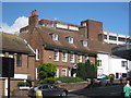
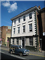
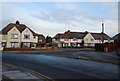
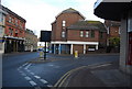

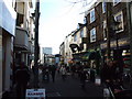
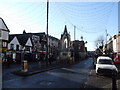
100 photos from this area
Area Information
Key information about the ME15 7UT including its size, population, and administrative classification.
- Area Type
- Postcode
- Area Size
- 5822 m²
- Population
- 2218
- Population Density
- 7299 people/km²
House Prices in ME15 7UT
66
Properties
£168,608
Average Sold Price
£25,500
Lowest Price
£272,500
Highest Price
Showing 66 properties
| Address | Type | Beds | Baths | Last Sale Price | Last Sale Date | |
|---|---|---|---|---|---|---|
| 70 Melville Road, Maidstone, ME15 7UT | Terraced | 1 | 1 | £175,000 | Apr 2023 | |
| 115 Melville Road, Maidstone, ME15 7UT | Terraced | 3 | 1 | £244,000 | Apr 2023 | |
| 109A Melville Road, Maidstone, ME15 7UT | Flat | 3 | 1 | £103,000 | Jan 2023 | |
| 103 Melville Road, Maidstone, ME15 7UT | Terraced | 3 | 1 | £272,500 | Oct 2022 | |
| 93 Melville Road, Maidstone, ME15 7UT | Terraced | 3 | - | £250,000 | Jun 2022 | |
| 72A Melville Road, Maidstone, ME15 7UT | Flat | - | - | £116,000 | Jun 2022 | |
| 84 Melville Road, Maidstone, ME15 7UT | Terraced | 2 | 1 | £255,000 | May 2022 | |
| 64 Melville Road, Maidstone, ME15 7UT | house | - | - | £225,000 | Mar 2021 | |
| 74 Melville Road, Maidstone, ME15 7UT | Terraced | 3 | 1 | £233,000 | Sep 2020 | |
| 91 Melville Road, Maidstone, ME15 7UT | Terraced | 2 | 1 | £221,000 | Sep 2020 |
Page 1 of 7
Energy Efficiency in ME15 7UT
Amenities
Schools
| Rank | School | Type | Entry gender | Ages |
|---|
Explore more schools in this area
Go to Schools tabDemographics
Household Size
Family (3-5 people)
most common
Accommodation Type
Houses
most common
Tenure
46
majority
Ethnic Group
White
most common
Religion
N/A
most common
Household Composition
N/A
most common
Age
47
median
Adults (30-64 years)
most common
Household Deprivation
N/A
with no deprivation
NS-SEC
27
in Lower managerial occupations
Explore more demographic insights in this area
Go to Demographics tabPlanning
Planning Constraints
- Flood RiskPremium
- Ramsar Wetland SitesPremium
- Area of Outstanding Natural BeautyPremium
- Protected Nature ReservePremium
- Protected WoodlandPremium