Area Overview for ME15 7SD
Photos of ME15 7SD


Area Information
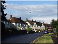
ME15 7SD is a small, tightly packed residential postcode in England, home to 1,690 people across a densely populated area. With a density of 1,557 people per square kilometre, this cluster of homes reflects a compact, community-oriented layout. The area’s character is defined by its proximity to key amenities, including multiple railway stations and retail hubs, making it practical for daily life. Residents here are predominantly adults aged 30–64, with a median age of 47, suggesting a mature, stable population. The high homeownership rate of 61% indicates a mix of long-term residents and families seeking stability. While the area lacks large-scale infrastructure, its small size ensures a sense of familiarity and accessibility. Living in ME15 7SD means being close to essential services, with a focus on local connectivity rather than sprawling development. The absence of major environmental constraints, such as protected woodlands or flood zones, adds to its appeal for those prioritising safety and practicality.
- Area Type
- Postcode
- Area Size
- Not available
- Population
- 1690
- Population Density
- 1557 people/km²
The property market in ME15 7SD is characterised by a high rate of homeownership (61%), indicating that most residents own their homes rather than rent. The accommodation type is predominantly houses, which contrasts with areas where flats or apartments dominate. This suggests a housing stock suited to families or individuals seeking private, standalone properties. Given the small size of the postcode, the market is likely limited in scope, with buyers needing to consider nearby areas for more options. The focus on owner-occupation implies a stable market with less turnover, which can be advantageous for long-term investors. However, the limited number of properties may mean competition for available homes, particularly for those seeking specific features. The absence of large-scale development or rental-focused schemes means the area is not a hotspot for short-term letting or speculative investment, but rather a place where residents prioritise permanence and local connection.
House Prices in ME15 7SD
No properties found in this postcode.
Energy Efficiency in ME15 7SD
Living in ME15 7SD offers access to essential retail and transport hubs within practical reach. The area is served by five retail venues, including Co-op Maidstone and Tesco Maidstone, providing convenient shopping options for groceries and daily necessities. These stores cater to both routine purchases and occasional needs, reducing the need for long trips to larger centres. The proximity to five railway stations, such as Maidstone West and Maidstone Barracks, enhances connectivity, allowing residents to travel efficiently for work, leisure, or socialising. While the area lacks large parks or recreational spaces, the rail links and retail options contribute to a lifestyle that prioritises convenience and accessibility. The compact nature of ME15 7SD means that amenities are close at hand, fostering a self-contained community where daily errands and travel are manageable without excessive commuting.
Amenities
Schools
The nearest school to ME15 7SD is Park Way Primary School, which has an Ofsted rating of ‘good’. This school serves the primary education needs of local children, offering a foundation for families with young dependents. The absence of secondary schools or other educational institutions in the immediate vicinity means parents may need to consider commuting for older children, though the proximity to rail stations could ease this. The single school listed highlights a focus on primary education within the area, which may be sufficient for families with younger children but less so for those requiring secondary schooling. The ‘good’ rating suggests a satisfactory standard of teaching and facilities, though further research would be needed to assess specific subjects or extracurricular offerings. For those prioritising primary education, Park Way Primary School is a key consideration.
| Rank | School | Type | Entry gender | Ages |
|---|
Explore more schools in this area
Go to Schools tabDemographics
The community in ME15 7SD is predominantly composed of adults aged 30–64, with a median age of 47. This age range suggests a population of established professionals and families, rather than a mix of younger or older demographics. Homeownership is strong, with 61% of residents owning their homes, indicating a stable, long-term presence in the area. The accommodation type is primarily houses, reflecting a preference for private, standalone properties over flats or shared housing. The predominant ethnic group is White, aligning with broader regional trends. With a population density of 1,557 people per square kilometre, the area is compact but not overcrowded, allowing for a balance between community density and individual space. The lack of specific data on deprivation means the quality of life is inferred from the low crime risk and absence of environmental hazards, suggesting a generally secure and functional living environment.
Household Size
Accommodation Type
Tenure
Ethnic Group
Religion
Household Composition
Age
Household Deprivation
NS-SEC
Explore more demographic insights in this area
Go to Demographics tabPlanning
Planning Constraints
- Flood RiskPremium
- Ramsar Wetland SitesPremium
- Area of Outstanding Natural BeautyPremium
- Protected Nature ReservePremium
- Protected WoodlandPremium