Area Overview for ME15 7QN
Photos of ME15 7QN
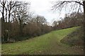

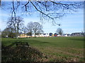
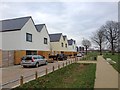
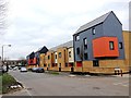
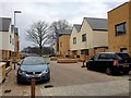
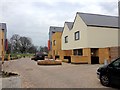
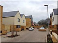
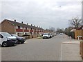
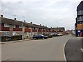
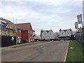
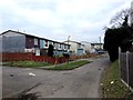
47 photos from this area
Area Information
Key information about the ME15 7QN including its size, population, and administrative classification.
- Area Type
- Postcode
- Area Size
- 1.7 hectares
- Population
- 1419
- Population Density
- 5633 people/km²
House Prices in ME15 7QN
38
Properties
£194,790
Average Sold Price
£57,995
Lowest Price
£315,000
Highest Price
Showing 38 properties
| Address | Type | Beds | Baths | Last Sale Price | Last Sale Date | |
|---|---|---|---|---|---|---|
| 43 Essex Road, Maidstone, ME15 7QN | Semi-detached | 3 | 1 | £301,000 | Jul 2025 | |
| 60 Essex Road, Maidstone, ME15 7QN | Semi-detached | 2 | 1 | £315,000 | Jul 2024 | |
| 31 Essex Road, Maidstone, ME15 7QN | Semi-detached | 3 | 1 | £290,000 | Dec 2023 | |
| 52 Essex Road, Maidstone, ME15 7QN | house | - | - | £277,000 | Dec 2022 | |
| 50 Essex Road, Maidstone, ME15 7QN | Retail | 2 | 1 | £310,000 | May 2022 | |
| 80 Essex Road, Maidstone, ME15 7QN | house | - | - | £315,000 | Mar 2022 | |
| 44 Essex Road, Maidstone, ME15 7QN | house | - | - | £280,000 | Jul 2021 | |
| 66 Essex Road, Maidstone, ME15 7QN | house | 3 | - | £262,600 | Jul 2018 | |
| 58 Essex Road, Maidstone, ME15 7QN | Terraced | 3 | 1 | £235,000 | May 2017 | |
| 40 Essex Road, Maidstone, ME15 7QN | Terraced | 4 | - | £215,000 | Jul 2016 |
Page 1 of 4
Energy Efficiency in ME15 7QN
Amenities
Schools
| Rank | School | Type | Entry gender | Ages |
|---|
Explore more schools in this area
Go to Schools tabDemographics
Household Size
One person
most common
Accommodation Type
Houses
most common
Tenure
43
majority
Ethnic Group
White
most common
Religion
N/A
most common
Household Composition
N/A
most common
Age
47
median
Adults (30-64 years)
most common
Household Deprivation
N/A
with no deprivation
NS-SEC
19
in Lower managerial occupations
Explore more demographic insights in this area
Go to Demographics tabPlanning
Planning Constraints
- Flood RiskPremium
- Ramsar Wetland SitesPremium
- Area of Outstanding Natural BeautyPremium
- Protected Nature ReservePremium
- Protected WoodlandPremium