Area Overview for ME15 6NP
Photos of ME15 6NP

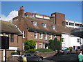
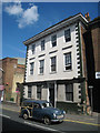
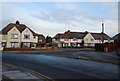
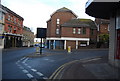
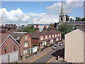
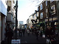
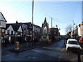
100 photos from this area
Area Information
Key information about the ME15 6NP including its size, population, and administrative classification.
- Area Type
- Postcode
- Area Size
- 4828 m²
- Population
- 2218
- Population Density
- 7299 people/km²
House Prices in ME15 6NP
32
Properties
£193,357
Average Sold Price
£38,000
Lowest Price
£300,000
Highest Price
Showing 32 properties
| Address | Type | Beds | Baths | Last Sale Price | Last Sale Date | |
|---|---|---|---|---|---|---|
| 36 Brunswick Street, Maidstone, ME15 6NP | Terraced | 4 | 1 | £295,000 | Sep 2025 | |
| 56 Brunswick Street, Maidstone, ME15 6NP | Terraced | 2 | 1 | £200,000 | Mar 2024 | |
| 64 Brunswick Street, Maidstone, ME15 6NP | house | 3 | - | £243,000 | May 2023 | |
| 42 Brunswick Street, Maidstone, ME15 6NP | Terraced | 2 | 1 | £255,000 | Oct 2022 | |
| 66 Brunswick Street, Maidstone, ME15 6NP | Terraced | 2 | 1 | £235,000 | Apr 2022 | |
| Brunswick Cottage, 70 Brunswick Street, Maidstone, ME15 6NP | Terraced | 2 | 1 | £285,000 | May 2021 | |
| 68 Brunswick Street, Maidstone, ME15 6NP | Semi-detached | 2 | 1 | £186,000 | Dec 2019 | |
| 72 Brunswick Street, Maidstone, ME15 6NP | Terraced | 3 | 2 | £300,000 | Aug 2018 | |
| 40 Brunswick Street, Maidstone, ME15 6NP | house | - | - | £172,000 | Nov 2016 | |
| 34 Brunswick Street, Maidstone, ME15 6NP | house | - | - | £150,000 | Jan 2009 |
Page 1 of 4
Energy Efficiency in ME15 6NP
Amenities
Schools
| Rank | School | Type | Entry gender | Ages |
|---|
Explore more schools in this area
Go to Schools tabDemographics
Household Size
Family (3-5 people)
most common
Accommodation Type
Houses
most common
Tenure
46
majority
Ethnic Group
White
most common
Religion
N/A
most common
Household Composition
N/A
most common
Age
47
median
Adults (30-64 years)
most common
Household Deprivation
N/A
with no deprivation
NS-SEC
27
in Lower managerial occupations
Explore more demographic insights in this area
Go to Demographics tabPlanning
Planning Constraints
- Flood RiskPremium
- Ramsar Wetland SitesPremium
- Area of Outstanding Natural BeautyPremium
- Protected Nature ReservePremium
- Protected WoodlandPremium