Area Overview for ME15 0PA
Photos of ME15 0PA
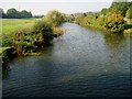
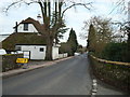
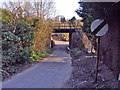
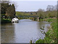
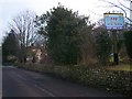
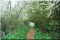
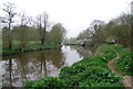
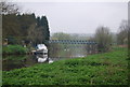

66 photos from this area
Area Information
Key information about the ME15 0PA including its size, population, and administrative classification.
- Area Type
- Postcode
- Area Size
- 8.8 hectares
- Population
- 1329
- Population Density
- 182 people/km²
House Prices in ME15 0PA
20
Properties
£337,667
Average Sold Price
£190,000
Lowest Price
£525,000
Highest Price
Showing 20 properties
| Address | Type | Beds | Baths | Last Sale Price | Last Sale Date | |
|---|---|---|---|---|---|---|
| Hillside, Charlton Lane, West Farleigh, ME15 0PA | Semi-detached | 4 | 2 | £525,000 | Aug 2025 | |
| Ashdown, Charlton Lane, West Farleigh, ME15 0PA | Bungalow | 3 | 1 | £500,000 | Oct 2024 | |
| Hoppers Corner, Charlton Lane, West Farleigh, ME15 0PA | house | - | - | £367,500 | Feb 2020 | |
| Lindsey, Charlton Lane, West Farleigh, ME15 0PA | Semi-detached | 3 | 1 | £370,000 | Feb 2019 | |
| Byways, Charlton Lane, West Farleigh, ME15 0PA | Semi-detached | 4 | 2 | £386,500 | Jul 2018 | |
| Rose Lawn, Charlton Lane, West Farleigh, ME15 0PA | house | - | - | £190,000 | May 2011 | |
| Red Tiles, Charlton Lane, West Farleigh, ME15 0PA | Detached | 4 | 2 | £270,000 | Aug 2004 | |
| Pickering, Charlton Lane, West Farleigh, ME15 0PA | Detached | - | - | £205,000 | Jul 2001 | |
| Green Oaks, Charlton Lane, West Farleigh, ME15 0PA | Detached | - | - | £225,000 | May 2001 | |
| Campana, Charlton Lane, West Farleigh, ME15 0PA | Detached | - | - | - | - |
Page 1 of 2
Energy Efficiency in ME15 0PA
Amenities
Schools
| Rank | School | Type | Entry gender | Ages |
|---|
Explore more schools in this area
Go to Schools tabDemographics
Household Size
Two person
most common
Accommodation Type
Houses
most common
Tenure
76
majority
Ethnic Group
White
most common
Religion
N/A
most common
Household Composition
N/A
most common
Age
47
median
Adults (30-64 years)
most common
Household Deprivation
N/A
with no deprivation
NS-SEC
39
in Lower managerial occupations
Explore more demographic insights in this area
Go to Demographics tabPlanning
Planning Constraints
- Flood RiskPremium
- Ramsar Wetland SitesPremium
- Area of Outstanding Natural BeautyPremium
- Protected Nature ReservePremium
- Protected WoodlandPremium