Area Overview for ME14 5UU
Photos of ME14 5UU
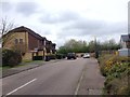
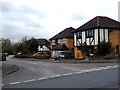
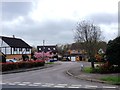
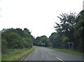
34 photos from this area
Area Information
Key information about the ME14 5UU including its size, population, and administrative classification.
- Area Type
- Postcode
- Area Size
- 4.1 hectares
- Population
- 1952
- Population Density
- 929 people/km²
House Prices in ME14 5UU
36
Properties
£418,111
Average Sold Price
£118,000
Lowest Price
£685,000
Highest Price
Showing 36 properties
| Address | Type | Beds | Baths | Last Sale Price | Last Sale Date | |
|---|---|---|---|---|---|---|
| 25 Shepherds Gate Drive, Weavering, ME14 5UU | Detached | 4 | 2 | £685,000 | Oct 2023 | |
| 7 Shepherds Gate Drive, Weavering, ME14 5UU | house | 4 | - | £655,000 | Nov 2022 | |
| 5 Shepherds Gate Drive, Weavering, ME14 5UU | house | - | - | £565,000 | Jan 2022 | |
| 15 Shepherds Gate Drive, Weavering, ME14 5UU | house | - | - | £650,000 | Apr 2021 | |
| 9 Shepherds Gate Drive, Weavering, ME14 5UU | Detached | 4 | 2 | £540,000 | Jul 2018 | |
| 36 Shepherds Gate Drive, Weavering, ME14 5UU | Semi-detached | 3 | 1 | £353,000 | Nov 2017 | |
| 14 Shepherds Gate Drive, Weavering, ME14 5UU | Detached | 4 | 2 | £585,000 | Sep 2017 | |
| 12 Shepherds Gate Drive, Weavering, ME14 5UU | house | - | - | £580,000 | Apr 2017 | |
| Sugar Loaves, 30 Shepherds Gate Drive, Weavering, ME14 5UU | Detached | 5 | - | £650,000 | Sep 2016 | |
| 10 Shepherds Gate Drive, Weavering, ME14 5UU | house | - | - | £430,000 | Aug 2015 |
Page 1 of 4
Energy Efficiency in ME14 5UU
Amenities
Schools
| Rank | School | Type | Entry gender | Ages |
|---|
Explore more schools in this area
Go to Schools tabDemographics
Household Size
Family (3-5 people)
most common
Accommodation Type
Houses
most common
Tenure
87
majority
Ethnic Group
White
most common
Religion
N/A
most common
Household Composition
N/A
most common
Age
47
median
Adults (30-64 years)
most common
Household Deprivation
N/A
with no deprivation
NS-SEC
45
in Lower managerial occupations
Explore more demographic insights in this area
Go to Demographics tabPlanning
Planning Constraints
- Flood RiskPremium
- Ramsar Wetland SitesPremium
- Area of Outstanding Natural BeautyPremium
- Protected Nature ReservePremium
- Protected WoodlandPremium