Area Overview for ME14 4PL
Photos of ME14 4PL
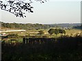
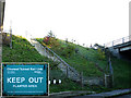

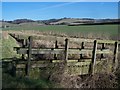


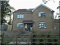
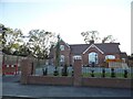
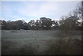
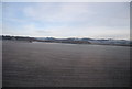
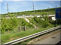
29 photos from this area
Area Information
Key information about the ME14 4PL including its size, population, and administrative classification.
- Area Type
- Postcode
- Area Size
- 39.2 hectares
- Population
- 1853
- Population Density
- 97 people/km²
House Prices in ME14 4PL
25
Properties
£545,500
Average Sold Price
£110,000
Lowest Price
£1,000,000
Highest Price
Showing 25 properties
| Address | Type | Beds | Baths | Last Sale Price | Last Sale Date | |
|---|---|---|---|---|---|---|
| Westmead, Thurnham Lane, Thurnham, ME14 4PL | Detached | 4 | 3 | £900,000 | Sep 2025 | |
| Yew Tree House, Thurnham Lane, Thurnham, ME14 4PL | Detached | 6 | 4 | £875,000 | Mar 2021 | |
| Old School House, Thurnham Lane, Thurnham, ME14 4PL | house | - | - | £1,000,000 | Mar 2016 | |
| Green Pastures, Thurnham Lane, Thurnham, ME14 4PL | Detached | 4 | 2 | £685,000 | Feb 2014 | |
| Woodside, Thurnham Lane, Thurnham, ME14 4PL | house | - | - | £380,000 | Jan 2011 | |
| The Schoolyard, Thurnham Lane, Thurnham, ME14 4PL | Detached | - | - | £600,000 | Nov 2006 | |
| Fairways, Thurnham Lane, Thurnham, ME14 4PL | Detached | - | - | £565,000 | Aug 2005 | |
| Thurnham House, Thurnham Lane, Thurnham, ME14 4PL | Detached | - | - | £165,000 | Nov 1998 | |
| Westview, Thurnham Lane, Thurnham, ME14 4PL | Semi-detached | - | - | £175,000 | Jun 1997 | |
| Stonecross, Thurnham Lane, Thurnham, ME14 4PL | Semi-detached | - | - | £110,000 | Jul 1995 |
Page 1 of 3
Energy Efficiency in ME14 4PL
Amenities
Schools
| Rank | School | Type | Entry gender | Ages |
|---|
Explore more schools in this area
Go to Schools tabDemographics
Household Size
Two person
most common
Accommodation Type
Houses
most common
Tenure
82
majority
Ethnic Group
White
most common
Religion
N/A
most common
Household Composition
N/A
most common
Age
47
median
Adults (30-64 years)
most common
Household Deprivation
N/A
with no deprivation
NS-SEC
46
in Lower managerial occupations
Explore more demographic insights in this area
Go to Demographics tabPlanning
Planning Constraints
- Flood RiskPremium
- Ramsar Wetland SitesPremium
- Area of Outstanding Natural BeautyPremium
- Protected Nature ReservePremium
- Protected WoodlandPremium