Area Overview for ME14 4LN
Photos of ME14 4LN
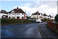
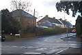
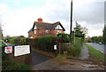
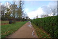

73 photos from this area
Area Information
Key information about the ME14 4LN including its size, population, and administrative classification.
- Area Type
- Postcode
- Area Size
- 2.3 hectares
- Population
- 1635
- Population Density
- 3248 people/km²
House Prices in ME14 4LN
55
Properties
£339,410
Average Sold Price
£110,000
Lowest Price
£620,000
Highest Price
Showing 55 properties
| Address | Type | Beds | Baths | Last Sale Price | Last Sale Date | |
|---|---|---|---|---|---|---|
| 74 Birling Avenue, Bearsted, ME14 4LN | Semi-detached | 3 | 1 | £365,000 | Mar 2025 | |
| 38 Birling Avenue, Bearsted, ME14 4LN | house | - | - | £272,500 | Jan 2025 | |
| 57 Birling Avenue, Bearsted, ME14 4LN | Semi-detached | 3 | 1 | £470,000 | Dec 2024 | |
| 45 Birling Avenue, Bearsted, ME14 4LN | Semi-detached | 3 | 2 | £425,000 | May 2024 | |
| 52 Birling Avenue, Bearsted, ME14 4LN | Detached | 3 | 1 | £565,000 | Dec 2023 | |
| 71 Birling Avenue, Bearsted, ME14 4LN | house | - | - | £377,500 | Dec 2023 | |
| 36 Birling Avenue, Bearsted, ME14 4LN | Semi-detached | 4 | 2 | £620,000 | Nov 2023 | |
| 48 Birling Avenue, Bearsted, ME14 4LN | Semi-detached | 3 | 1 | £530,750 | Jul 2023 | |
| 53 Birling Avenue, Bearsted, ME14 4LN | Semi-detached | 3 | 1 | £457,500 | Jun 2021 | |
| 81 Birling Avenue, Bearsted, ME14 4LN | Semi-detached | 4 | 1 | £370,000 | Apr 2021 |
Page 1 of 6
Energy Efficiency in ME14 4LN
Amenities
Schools
| Rank | School | Type | Entry gender | Ages |
|---|
Explore more schools in this area
Go to Schools tabDemographics
Household Size
Family (3-5 people)
most common
Accommodation Type
Houses
most common
Tenure
92
majority
Ethnic Group
White
most common
Religion
N/A
most common
Household Composition
N/A
most common
Age
47
median
Adults (30-64 years)
most common
Household Deprivation
N/A
with no deprivation
NS-SEC
50
in Lower managerial occupations
Explore more demographic insights in this area
Go to Demographics tabPlanning
Planning Constraints
- Flood RiskPremium
- Ramsar Wetland SitesPremium
- Area of Outstanding Natural BeautyPremium
- Protected Nature ReservePremium
- Protected WoodlandPremium