Area Overview for ME14 4JS
Photos of ME14 4JS
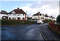
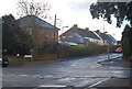
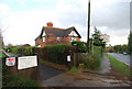
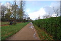
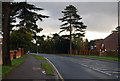
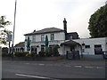
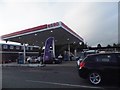
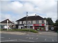
73 photos from this area
Area Information
Key information about the ME14 4JS including its size, population, and administrative classification.
- Area Type
- Postcode
- Area Size
- 2.0 hectares
- Population
- 1555
- Population Density
- 1811 people/km²
House Prices in ME14 4JS
32
Properties
£368,032
Average Sold Price
£128,500
Lowest Price
£617,500
Highest Price
Showing 32 properties
| Address | Type | Beds | Baths | Last Sale Price | Last Sale Date | |
|---|---|---|---|---|---|---|
| 3 Nursery Avenue, Bearsted, ME14 4JS | Bungalow | 3 | 2 | £575,000 | Oct 2025 | |
| 8 Nursery Avenue, Bearsted, ME14 4JS | Bungalow | 3 | 1 | £565,000 | Aug 2025 | |
| 1 Nursery Avenue, Bearsted, ME14 4JS | Bungalow | 3 | 1 | £592,500 | Mar 2024 | |
| 7 Nursery Avenue, Bearsted, ME14 4JS | Bungalow | - | - | £617,500 | May 2022 | |
| 32 Nursery Avenue, Bearsted, ME14 4JS | Bungalow | 3 | 1 | £395,000 | Dec 2020 | |
| 15 Nursery Avenue, Bearsted, ME14 4JS | Bungalow | - | - | £475,000 | Jul 2020 | |
| 6 Nursery Avenue, Bearsted, ME14 4JS | Bungalow | - | - | £525,000 | Jul 2019 | |
| 28 Nursery Avenue, Bearsted, ME14 4JS | Bungalow | - | - | £475,000 | Mar 2018 | |
| 13 Nursery Avenue, Bearsted, ME14 4JS | Bungalow | - | - | £499,500 | Jun 2017 | |
| 2 Nursery Avenue, Bearsted, ME14 4JS | Bungalow | 4 | - | £425,000 | May 2015 |
Page 1 of 4
Energy Efficiency in ME14 4JS
Amenities
Schools
| Rank | School | Type | Entry gender | Ages |
|---|
Explore more schools in this area
Go to Schools tabDemographics
Household Size
Two person
most common
Accommodation Type
Houses
most common
Tenure
90
majority
Ethnic Group
White
most common
Religion
N/A
most common
Household Composition
N/A
most common
Age
47
median
Adults (30-64 years)
most common
Household Deprivation
N/A
with no deprivation
NS-SEC
45
in Lower managerial occupations
Explore more demographic insights in this area
Go to Demographics tabPlanning
Planning Constraints
- Flood RiskPremium
- Ramsar Wetland SitesPremium
- Area of Outstanding Natural BeautyPremium
- Protected Nature ReservePremium
- Protected WoodlandPremium