Area Overview for ME14 3JQ
Photos of ME14 3JQ


Area Information
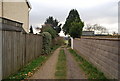
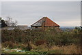
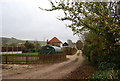
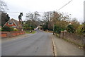
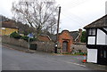
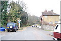
Living in ME14 3JQ offers a quiet, residential experience within a small cluster of homes. With a population of 1,853 and a density of 97 people per square kilometre, the area feels intimate yet connected to nearby towns. The community is predominantly composed of adults aged 30–64, with a median age of 47, suggesting a stable, mature demographic. Home ownership is high at 82%, reflecting a long-term presence of families and individuals. Daily life here is shaped by proximity to local amenities, including retail hubs like M&S Maidstone and Morrisons Daily Penenden, and easy access to rail networks such as Bearsted and Maidstone East stations. The area’s low crime risk and absence of environmental constraints like AONB or Ramsar sites make it appealing for those seeking a balanced lifestyle. Residents benefit from a mix of practical connectivity, including a nearby airport, and a focus on private housing over rental properties. This postcode is ideal for those prioritising safety, convenience, and a settled community.
- Area Type
- Postcode
- Area Size
- Not available
- Population
- 1853
- Population Density
- 97 people/km²
The property market in ME14 3JQ is dominated by owner-occupied homes, with 82% of properties owned by residents rather than rented. This high ownership rate indicates a community of long-term residents, often families, who have invested in their homes. The accommodation type is primarily houses, which is unusual for areas with higher density but makes sense in ME14 3JQ’s small, spread-out layout. This suggests a focus on private, standalone properties rather than apartments or terraced housing. For buyers, this means the market is likely to be stable, with properties retaining value due to low turnover. The small size of the area and its proximity to amenities like rail stations and retail centres may make it attractive to those seeking a balance between suburban tranquillity and accessible services. However, the limited data on property types or price ranges means specific investment opportunities remain unclear.
House Prices in ME14 3JQ
No properties found in this postcode.
Energy Efficiency in ME14 3JQ
Residents of ME14 3JQ have access to a range of practical amenities within reach. Retail options include major stores like M&S Maidstone, Tesco Maidstone, and Morrisons Daily Penenden, providing convenience for shopping and daily needs. The area’s rail network connects to Bearsted, Maidstone East, and Maidstone Barracks stations, facilitating easy travel to nearby towns and cities. The proximity to Rochester Airport adds to the area’s accessibility, though it is likely more suited to regional travel than long-haul flights. While the data does not mention parks or leisure facilities, the low population density and absence of environmental constraints suggest open spaces may be available nearby. The combination of retail, transport, and connectivity options supports a lifestyle that balances local convenience with broader mobility.
Amenities
Schools
The nearest school to ME14 3JQ is Detling Church of England Primary School, which serves the local community with primary education. No secondary schools are listed in the data, so families with older children may need to look further afield. The presence of a primary school suggests that the area is well-suited for families with young children, though the absence of nearby secondary education could be a consideration for those planning for long-term schooling. The school’s type—Church of England—indicates a faith-based educational approach, though specific Ofsted ratings or academic performance metrics are not provided. For parents, the proximity of a primary school is a key advantage, but they may need to rely on transport links or neighbouring areas for secondary schooling.
| Rank | School | Type | Entry gender | Ages |
|---|
Explore more schools in this area
Go to Schools tabDemographics
The population of ME14 3JQ is predominantly adults aged 30–64, with a median age of 47. This suggests a community of established professionals and families, rather than students or retirees. Home ownership is high at 82%, indicating a strong preference for long-term residency over rental properties. The accommodation type is primarily houses, which aligns with the area’s low population density and residential character. The predominant ethnic group is White, though no specific data on diversity or deprivation levels is provided. The age profile and ownership rates suggest a stable, low-turnover community where families are likely to remain for extended periods. The absence of detailed diversity metrics means the area’s social composition remains somewhat opaque, but the demographic data points to a cohesive, middle-aged population with a focus on homeownership.
Household Size
Accommodation Type
Tenure
Ethnic Group
Religion
Household Composition
Age
Household Deprivation
NS-SEC
Explore more demographic insights in this area
Go to Demographics tabPlanning
Planning Constraints
- Flood RiskPremium
- Ramsar Wetland SitesPremium
- Area of Outstanding Natural BeautyPremium
- Protected Nature ReservePremium
- Protected WoodlandPremium