Area Overview for ME14 2TS
Photos of ME14 2TS

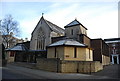
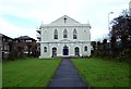

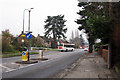
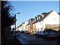
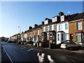
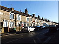
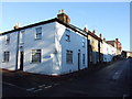
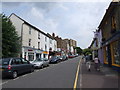
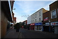
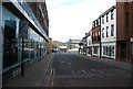
100 photos from this area
Area Information
Key information about the ME14 2TS including its size, population, and administrative classification.
- Area Type
- Postcode
- Area Size
- 7566 m²
- Population
- 2003
- Population Density
- 8236 people/km²
House Prices in ME14 2TS
55
Properties
£174,939
Average Sold Price
£49,000
Lowest Price
£261,000
Highest Price
Showing 55 properties
| Address | Type | Beds | Baths | Last Sale Price | Last Sale Date | |
|---|---|---|---|---|---|---|
| 70 Grecian Street, Maidstone, ME14 2TS | Terraced | 3 | 2 | £260,000 | Mar 2025 | |
| 84 Grecian Street, Maidstone, ME14 2TS | Terraced | 2 | 1 | £261,000 | Mar 2025 | |
| 102 Grecian Street, Maidstone, ME14 2TS | Terraced | 1 | 1 | £238,000 | Aug 2024 | |
| 10 Grecian Street, Maidstone, ME14 2TS | Terraced | 2 | 1 | £255,000 | Dec 2023 | |
| 22 Grecian Street, Maidstone, ME14 2TS | Terraced | 2 | 1 | £225,000 | Oct 2021 | |
| 20 Grecian Street, Maidstone, ME14 2TS | Terraced | 2 | 1 | £240,000 | Sep 2021 | |
| 90 Grecian Street, Maidstone, ME14 2TS | Terraced | 2 | 1 | £228,000 | Aug 2021 | |
| 56 Grecian Street, Maidstone, ME14 2TS | Terraced | 2 | 1 | £232,500 | Mar 2021 | |
| 28 Grecian Street, Maidstone, ME14 2TS | Terraced | 2 | 1 | £222,500 | Oct 2020 | |
| 54 Grecian Street, Maidstone, ME14 2TS | Terraced | 2 | 1 | £247,500 | Aug 2020 |
Page 1 of 6
Energy Efficiency in ME14 2TS
Amenities
Schools
| Rank | School | Type | Entry gender | Ages |
|---|
Explore more schools in this area
Go to Schools tabDemographics
Household Size
Family (3-5 people)
most common
Accommodation Type
Houses
most common
Tenure
67
majority
Ethnic Group
White
most common
Religion
N/A
most common
Household Composition
N/A
most common
Age
47
median
Adults (30-64 years)
most common
Household Deprivation
N/A
with no deprivation
NS-SEC
38
in Lower managerial occupations
Explore more demographic insights in this area
Go to Demographics tabPlanning
Planning Constraints
- Flood RiskPremium
- Ramsar Wetland SitesPremium
- Area of Outstanding Natural BeautyPremium
- Protected Nature ReservePremium
- Protected WoodlandPremium