Area Overview for ME14 1RN
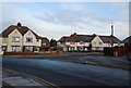
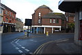
Photos of ME14 1RN


Area Information
ME14 1RN is a small, densely populated postcode area in England, covering just 2781 square metres and home to 1153 residents. With a population density of 414,660 people per square kilometre, this is a tightly knit residential cluster, likely centred around a specific development or housing scheme. The area’s compact size suggests a focused community character, though its high density may influence local dynamics. The demographic profile indicates a mature population, with a median age of 47 and a majority of residents aged 30–64. This suggests a stable, established community, possibly with a mix of long-term residents and professionals working in nearby towns. Living here means proximity to essential services, though the limited space may mean a strong reliance on nearby amenities. The area’s small footprint and high density make it a distinct microcosm within the broader regional context, offering a compact lifestyle with clear boundaries.
- Area Type
- Postcode
- Area Size
- 2781 m²
- Population
- 1153
- Population Density
- 4592 people/km²
The property market in ME14 1RN is characterised by a very low rate of home ownership (13%), indicating that the majority of properties are rented out rather than owner-occupied. This suggests a rental-focused market, which may appeal to tenants seeking stable, long-term housing. The accommodation type is predominantly flats, which is typical for high-density areas. This housing stock likely consists of purpose-built blocks or converted buildings, offering a compact living environment. For buyers, the small area and limited number of properties mean competition is likely to be fierce, with few opportunities for purchase. The focus on rental properties may also mean that properties are more likely to be let out to tenants, potentially limiting the appeal for those seeking a long-term home. The market’s character is defined by its practicality, with a clear emphasis on affordability and accessibility over luxury or investment potential.
House Prices in ME14 1RN
Showing 4 properties
| Address | Type | Beds | Baths | Last Sale Price | Last Sale Date | |
|---|---|---|---|---|---|---|
| Flat 1, 24 Week Street, Maidstone, ME14 1RN | Flat | 2 | 2 | - | - | |
| Flat 2, 24 Week Street, Maidstone, ME14 1RN | Flat | - | - | - | - | |
| Flat 3, 24 Week Street, Maidstone, ME14 1RN | Flat | 1 | 1 | - | - | |
| 22A Week Street, Maidstone, ME14 1RN | Flat | 2 | 1 | - | - |
Energy Efficiency in ME14 1RN
Living in ME14 1RN provides access to a range of nearby amenities, including five retail outlets such as Iceland Maidstone, Tesco Week, and Sainsburys Maidstone. These shops offer convenience for daily shopping, with a mix of supermarket chains and local stores. The area’s proximity to multiple railway stations—Maidstone East, West, and Barracks—ensures easy access to regional transport, facilitating travel to nearby towns and cities. Rochester Airport is also within reach, adding to the area’s connectivity. While the data does not specify parks or leisure facilities, the presence of retail and transport hubs suggests a practical, service-oriented lifestyle. The compact nature of the area may mean that residents rely heavily on nearby towns for broader leisure options, though the immediate vicinity offers sufficient convenience for daily needs.
Amenities
Schools
The schools near ME14 1RN include the Mid-Kent Behaviour Service & Education Office, which is categorised as ‘other,’ and MEPA ACADEMY, an independent school with a ‘good’ Ofsted rating. MEPA ACADEMY’s independent status suggests it may cater to families seeking alternative or specialist education, while the Mid-Kent service appears to focus on behavioural support or education for specific needs. The presence of both school types offers a range of options for families, though the limited number of schools may mean parents need to consider commuting to nearby areas for broader choices. The ‘good’ rating at MEPA ACADEMY is a positive indicator for families prioritising quality education, but the overall scarcity of schools in the immediate vicinity could be a concern for those requiring multiple options.
| Rank | School | Type | Entry gender | Ages |
|---|
Explore more schools in this area
Go to Schools tabDemographics
The population of ME14 1RN is predominantly adults aged 30–64, with a median age of 47. This indicates a mature, settled community with a low proportion of younger or elderly residents. Home ownership is minimal, with only 13% of properties owned by residents, suggesting a rental-dominated market. The accommodation type is primarily flats, reflecting a high-rise or purpose-built housing stock. The predominant ethnic group is White, though specific data on diversity is not provided. The low home ownership rate may imply a transient population or a focus on rental properties, which could affect community cohesion. For buyers, this suggests a market where long-term investment may be less common, and properties are more likely to be let out. The area’s demographic profile aligns with a practical, functional living environment rather than a family-oriented or rapidly growing community.
Household Size
Accommodation Type
Tenure
Ethnic Group
Religion
Household Composition
Age
Household Deprivation
NS-SEC
Explore more demographic insights in this area
Go to Demographics tabPlanning
Planning Constraints
- Flood RiskPremium
- Ramsar Wetland SitesPremium
- Area of Outstanding Natural BeautyPremium
- Protected Nature ReservePremium
- Protected WoodlandPremium