Area Overview for ME13 9LR
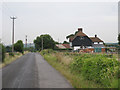
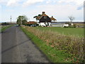
Photos of ME13 9LR


Area Information
ME13 9LR is a small, tightly knit residential postcode in England, covering just 2.3 hectares with a population of 1733. Its low population density of 87 people per square kilometre suggests a quiet, spread-out community, likely characterised by individual homes rather than high-density housing. The area’s compact size means it is likely surrounded by open land or smaller villages, offering a sense of seclusion. Residents here are predominantly adults aged 30–64, with a median age of 47, indicating a mature, stable population. The proximity to rail stations like Selling and Chilham suggests easy access to nearby towns, while the presence of Dunkirk Village School ensures families have a primary education option nearby. Daily life in ME13 9LR appears to revolve around local amenities, community routines, and a balance between rural tranquillity and connectivity. The low flood risk and below-average crime rates further reinforce its appeal as a safe, low-stress environment for homeowners.
- Area Type
- Postcode
- Area Size
- 2.3 hectares
- Population
- 1733
- Population Density
- 87 people/km²
ME13 9LR is an owner-occupied area, with 82% of homes owned by residents rather than rented. The accommodation type is primarily houses, which is typical for small, low-density postcode areas. This suggests a housing stock that is likely older, with individual properties rather than apartments or flats. Given the area’s size and population, the property market is limited in scale, with a small number of homes available. Buyers should consider that the proximity to rail stations and schools may make this area attractive to those seeking a balance between rural living and access to amenities. However, the small size of the postcode means the immediate surroundings are critical for additional housing options. The high home ownership rate indicates a stable market, but potential buyers may need to look beyond ME13 9LR for a broader selection of properties.
House Prices in ME13 9LR
No properties found in this postcode.
Energy Efficiency in ME13 9LR
The lifestyle in ME13 9LR is shaped by its proximity to five retail outlets, including Spar, Budgens Thanet, and Co-op Kent. These shops provide essential services for daily living, from groceries to convenience items, reducing the need for long trips to larger towns. The rail stations nearby add to the area’s convenience, offering access to cultural, social, and employment opportunities beyond the immediate postcode. While the data does not specify parks or leisure facilities, the low population density suggests potential for open spaces or green areas nearby. The small size of the area means that amenities are within practical reach, fostering a self-contained community. For residents, this balance of local shops, transport links, and a quiet environment creates a lifestyle that prioritises simplicity and accessibility.
Amenities
Schools
The nearest school to ME13 9LR is Dunkirk Village School, a primary school serving the local community. While no Ofsted rating is provided, the presence of a primary school within the area is a key consideration for families with young children. The absence of secondary schools in the data means that students may need to travel to nearby towns for further education. The single school type suggests a focus on early education, which could be a limitation for families requiring a full range of educational facilities. However, the proximity of Dunkirk Village School reduces commuting time for parents and ensures children are served by a local institution. For those prioritising school catchment areas, this primary school is a clear advantage.
| Rank | School | Type | Entry gender | Ages |
|---|---|---|---|---|
| 1 | Dunkirk Village School | primary | N/A | N/A |
Explore more schools in this area
Go to Schools tabDemographics
The population of ME13 9LR is 1733, with a median age of 47. This suggests a community skewed towards middle-aged and older adults, with the most common age range being 30–64 years. Home ownership is high at 82%, reflecting a predominantly owner-occupied area rather than a rental market. The accommodation type is primarily houses, which aligns with the area’s low density and likely rural or semi-rural character. The predominant ethnic group is White, which, while not indicating diversity in terms of ethnicity, does not preclude cultural or social diversity in other forms. The high home ownership rate and mature age profile suggest a settled population with long-term ties to the area. For quality of life, this demographic may prioritise stability, proximity to essential services, and a slower pace of life over urban conveniences.
Household Size
Accommodation Type
Tenure
Ethnic Group
Religion
Household Composition
Age
Household Deprivation
NS-SEC
Explore more demographic insights in this area
Go to Demographics tabPlanning
Planning Constraints
- Flood RiskPremium
- Ramsar Wetland SitesPremium
- Area of Outstanding Natural BeautyPremium
- Protected Nature ReservePremium
- Protected WoodlandPremium
- Crime RiskPremium