Area Overview for ME13 8SW
Photos of ME13 8SW
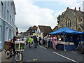
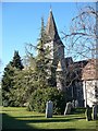
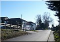

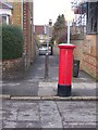
100 photos from this area
Area Information
Key information about the ME13 8SW including its size, population, and administrative classification.
- Area Type
- Postcode
- Area Size
- 4707 m²
- Population
- 2052
- Population Density
- 1872 people/km²
House Prices in ME13 8SW
14
Properties
£420,374
Average Sold Price
£284,995
Lowest Price
£557,995
Highest Price
Showing 14 properties
| Address | Type | Beds | Baths | Last Sale Price | Last Sale Date | |
|---|---|---|---|---|---|---|
| 14 Concorde Street, Faversham, ME13 8SW | Detached | 4 | 3 | £445,000 | Mar 2025 | |
| 1 Concorde Street, Faversham, ME13 8SW | Detached | 4 | 2 | £435,000 | Nov 2024 | |
| 11 Concorde Street, Faversham, ME13 8SW | house | - | - | £499,995 | Jan 2022 | |
| 6 Concorde Street, Faversham, ME13 8SW | Detached | - | - | £557,995 | Dec 2021 | |
| 12 Concorde Street, Faversham, ME13 8SW | Detached | - | - | £515,995 | Sep 2021 | |
| 10 Concorde Street, Faversham, ME13 8SW | Detached | - | - | £392,995 | Sep 2021 | |
| 8 Concorde Street, Faversham, ME13 8SW | Detached | - | - | £555,995 | Aug 2021 | |
| 9 Concorde Street, Faversham, ME13 8SW | house | - | - | £404,995 | Jun 2021 | |
| 2 Concorde Street, Faversham, ME13 8SW | Detached | 4 | 3 | £384,995 | May 2021 | |
| 4 Concorde Street, Faversham, ME13 8SW | Detached | - | - | £373,295 | May 2021 |
Page 1 of 2
Energy Efficiency in ME13 8SW
Amenities
Schools
| Rank | School | Type | Entry gender | Ages |
|---|
Explore more schools in this area
Go to Schools tabDemographics
Household Size
Family (3-5 people)
most common
Accommodation Type
Houses
most common
Tenure
82
majority
Ethnic Group
White
most common
Religion
N/A
most common
Household Composition
N/A
most common
Age
47
median
Adults (30-64 years)
most common
Household Deprivation
N/A
with no deprivation
NS-SEC
46
in Lower managerial occupations
Explore more demographic insights in this area
Go to Demographics tabPlanning
Planning Constraints
- Flood RiskPremium
- Ramsar Wetland SitesPremium
- Area of Outstanding Natural BeautyPremium
- Protected Nature ReservePremium
- Protected WoodlandPremium