Area Overview for ME13 8QG
Photos of ME13 8QG
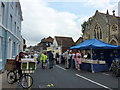
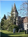
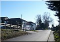

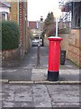
100 photos from this area
Area Information
Key information about the ME13 8QG including its size, population, and administrative classification.
- Area Type
- Postcode
- Area Size
- 1.0 hectares
- Population
- 1902
- Population Density
- 951 people/km²
House Prices in ME13 8QG
19
Properties
£253,269
Average Sold Price
£99,500
Lowest Price
£480,000
Highest Price
Showing 19 properties
| Address | Type | Beds | Baths | Last Sale Price | Last Sale Date | |
|---|---|---|---|---|---|---|
| 35 Forbes Road, Faversham, ME13 8QG | Terraced | 5 | 2 | £480,000 | Jul 2024 | |
| 26 Forbes Road, Faversham, ME13 8QG | Semi-detached | 3 | 2 | £355,000 | Dec 2022 | |
| 27 Forbes Road, Faversham, ME13 8QG | house | 3 | 2 | £350,000 | Aug 2022 | |
| 37 Forbes Road, Faversham, ME13 8QG | house | - | - | £400,000 | Sep 2021 | |
| 23 Forbes Road, Faversham, ME13 8QG | Terraced | 4 | - | £235,000 | Sep 2021 | |
| 31 Forbes Road, Faversham, ME13 8QG | house | - | - | £250,000 | Nov 2020 | |
| 22 Forbes Road, Faversham, ME13 8QG | Bungalow | - | - | £240,000 | Jun 2016 | |
| 40 Forbes Road, Faversham, ME13 8QG | house | - | - | £238,000 | Oct 2013 | |
| 30 Forbes Road, Faversham, ME13 8QG | house | 3 | - | £133,000 | Jan 2012 | |
| 29 Forbes Road, Faversham, ME13 8QG | Semi-detached | 2 | 1 | £142,000 | Dec 2011 |
Page 1 of 2
Energy Efficiency in ME13 8QG
Amenities
Schools
| Rank | School | Type | Entry gender | Ages |
|---|
Explore more schools in this area
Go to Schools tabDemographics
Household Size
Two person
most common
Accommodation Type
Houses
most common
Tenure
81
majority
Ethnic Group
White
most common
Religion
N/A
most common
Household Composition
N/A
most common
Age
47
median
Adults (30-64 years)
most common
Household Deprivation
N/A
with no deprivation
NS-SEC
41
in Lower managerial occupations
Explore more demographic insights in this area
Go to Demographics tabPlanning
Planning Constraints
- Flood RiskPremium
- Ramsar Wetland SitesPremium
- Area of Outstanding Natural BeautyPremium
- Protected Nature ReservePremium
- Protected WoodlandPremium