Area Overview for ME13 8DA
Photos of ME13 8DA
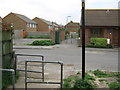
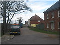
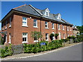
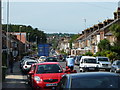
100 photos from this area
Area Information
Key information about the ME13 8DA including its size, population, and administrative classification.
- Area Type
- Postcode
- Area Size
- 6556 m²
- Population
- 2193
- Population Density
- 5521 people/km²
House Prices in ME13 8DA
16
Properties
£211,200
Average Sold Price
£142,000
Lowest Price
£370,000
Highest Price
Showing 16 properties
| Address | Type | Beds | Baths | Last Sale Price | Last Sale Date | |
|---|---|---|---|---|---|---|
| 11 Cole Road, Faversham, ME13 8DA | Terraced | 2 | 1 | £275,000 | Jul 2024 | |
| 3 Cole Road, Faversham, ME13 8DA | Terraced | 3 | 2 | £370,000 | Oct 2023 | |
| 21 Cole Road, Faversham, ME13 8DA | Terraced | 2 | 1 | £235,000 | Mar 2019 | |
| 19 Cole Road, Faversham, ME13 8DA | house | - | - | £200,000 | Aug 2017 | |
| 15 Cole Road, Faversham, ME13 8DA | Terraced | 2 | 1 | £230,000 | Jul 2017 | |
| 23 Cole Road, Faversham, ME13 8DA | Terraced | 2 | - | £182,500 | Apr 2014 | |
| 9 Cole Road, Faversham, ME13 8DA | Terraced | - | - | £150,000 | Aug 2008 | |
| 4 Cole Road, Faversham, ME13 8DA | house | - | - | £165,000 | Oct 2007 | |
| 17 Cole Road, Faversham, ME13 8DA | Terraced | - | - | £162,500 | Mar 2007 | |
| 13 Cole Road, Faversham, ME13 8DA | Terraced | - | - | £142,000 | Aug 2006 |
Page 1 of 2
Energy Efficiency in ME13 8DA
Amenities
Schools
| Rank | School | Type | Entry gender | Ages |
|---|
Explore more schools in this area
Go to Schools tabDemographics
Household Size
Two person
most common
Accommodation Type
Houses
most common
Tenure
63
majority
Ethnic Group
White
most common
Religion
N/A
most common
Household Composition
N/A
most common
Age
47
median
Adults (30-64 years)
most common
Household Deprivation
N/A
with no deprivation
NS-SEC
32
in Lower managerial occupations
Explore more demographic insights in this area
Go to Demographics tabPlanning
Planning Constraints
- Flood RiskPremium
- Ramsar Wetland SitesPremium
- Area of Outstanding Natural BeautyPremium
- Protected Nature ReservePremium
- Protected WoodlandPremium