Area Overview for ME13 7JQ
Photos of ME13 7JQ
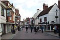
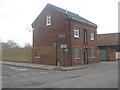
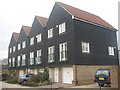
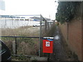
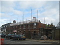
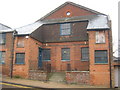
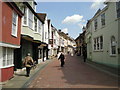
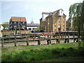
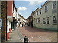
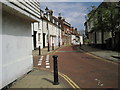
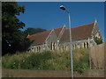
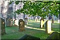
100 photos from this area
Area Information
Key information about the ME13 7JQ including its size, population, and administrative classification.
- Area Type
- Postcode
- Area Size
- 1.4 hectares
- Population
- 1410
- Population Density
- 5999 people/km²
House Prices in ME13 7JQ
23
Properties
£384,559
Average Sold Price
£107,500
Lowest Price
£715,000
Highest Price
Showing 23 properties
| Address | Type | Beds | Baths | Last Sale Price | Last Sale Date | |
|---|---|---|---|---|---|---|
| 67 West Street, Faversham, ME13 7JQ | house | 3 | 1 | £295,000 | Apr 2024 | |
| 95 West Street, Faversham, ME13 7JQ | Terraced | 4 | 2 | £715,000 | Jun 2023 | |
| 66 West Street, Faversham, ME13 7JQ | house | 2 | 1 | £335,000 | Nov 2022 | |
| 75 West Street, Faversham, ME13 7JQ | house | 4 | - | £550,000 | Jul 2022 | |
| 68 West Street, Faversham, ME13 7JQ | Terraced | 2 | 1 | £275,000 | Mar 2021 | |
| 94 West Street, Faversham, ME13 7JQ | Terraced | 4 | 3 | £575,000 | Dec 2020 | |
| 71 West Street, Faversham, ME13 7JQ | Terraced | 1 | 1 | £235,000 | Oct 2017 | |
| White Horse, 99 West Street, Faversham, ME13 7JQ | Terraced | 4 | 3 | £365,000 | May 2017 | |
| 73 West Street, Faversham, ME13 7JQ | Terraced | 3 | 1 | £350,000 | Jan 2017 | |
| 78 West Street, Faversham, ME13 7JQ | Terraced | - | - | £685,000 | Jul 2014 |
Page 1 of 3
Energy Efficiency in ME13 7JQ
Amenities
Schools
| Rank | School | Type | Entry gender | Ages |
|---|
Explore more schools in this area
Go to Schools tabDemographics
Household Size
One person
most common
Accommodation Type
Houses
most common
Tenure
71
majority
Ethnic Group
White
most common
Religion
N/A
most common
Household Composition
N/A
most common
Age
47
median
Adults (30-64 years)
most common
Household Deprivation
N/A
with no deprivation
NS-SEC
40
in Lower managerial occupations
Explore more demographic insights in this area
Go to Demographics tabPlanning
Planning Constraints
- Flood RiskPremium
- Ramsar Wetland SitesPremium
- Area of Outstanding Natural BeautyPremium
- Protected Nature ReservePremium
- Protected WoodlandPremium