Area Overview for ME13 0PJ
Photos of ME13 0PJ
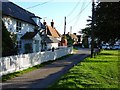
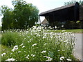
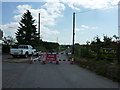
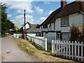
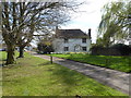
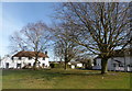
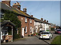
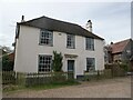
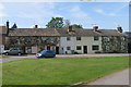
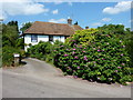
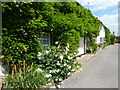
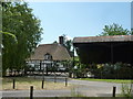
19 photos from this area
Area Information
Key information about the ME13 0PJ including its size, population, and administrative classification.
- Area Type
- Postcode
- Area Size
- 62.2 hectares
- Population
- 1248
- Population Density
- 43 people/km²
House Prices in ME13 0PJ
43
Properties
£318,210
Average Sold Price
£57,605
Lowest Price
£625,000
Highest Price
Showing 43 properties
| Address | Type | Beds | Baths | Last Sale Price | Last Sale Date | |
|---|---|---|---|---|---|---|
| Mill House, Almshouse Road, Throwley Forstal, ME13 0PJ | Bungalow | 4 | - | £625,000 | Oct 2024 | |
| 1, Jubilee Cottages, Almshouse Road, Throwley Forstal, ME13 0PJ | Cottage | 3 | 1 | £320,000 | Apr 2023 | |
| 5, Jubilee Cottages, Almshouse Road, Throwley Forstal, ME13 0PJ | house | - | - | £260,000 | Jun 2021 | |
| Forge House, Almshouse Road, Throwley Forstal, ME13 0PJ | Detached | 3 | 2 | £599,995 | Jun 2021 | |
| Beeches, Almshouse Road, Throwley Forstal, ME13 0PJ | Detached | 4 | 3 | £602,500 | Sep 2018 | |
| Sunnyside, Almshouse Road, Throwley Forstal, ME13 0PJ | Terraced | 3 | - | £215,000 | Mar 2014 | |
| 3, Jubilee Cottages, Almshouse Road, Throwley Forstal, ME13 0PJ | house | 2 | - | £167,000 | Aug 2004 | |
| 2, Jubilee Cottages, Almshouse Road, Throwley Forstal, ME13 0PJ | Terraced | - | - | £57,605 | Mar 2004 | |
| Forge Farm, Almshouse Road, Throwley Forstal, ME13 0PJ | Detached | - | - | £205,000 | Nov 1998 | |
| Forstal House, Almshouse Road, Throwley Forstal, ME13 0PJ | Detached | 3 | 1 | £130,000 | May 1995 |
Page 1 of 5
Energy Efficiency in ME13 0PJ
Amenities
Schools
| Rank | School | Type | Entry gender | Ages |
|---|
Explore more schools in this area
Go to Schools tabDemographics
Household Size
Two person
most common
Accommodation Type
Houses
most common
Tenure
72
majority
Ethnic Group
White
most common
Religion
N/A
most common
Household Composition
N/A
most common
Age
47
median
Adults (30-64 years)
most common
Household Deprivation
N/A
with no deprivation
NS-SEC
36
in Lower managerial occupations
Explore more demographic insights in this area
Go to Demographics tabPlanning
Planning Constraints
- Flood RiskPremium
- Ramsar Wetland SitesPremium
- Area of Outstanding Natural BeautyPremium
- Protected Nature ReservePremium
- Protected WoodlandPremium