Area Overview for ME12 3SE
Photos of ME12 3SE


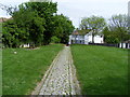
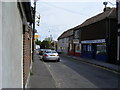
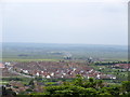
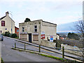
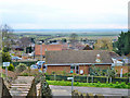
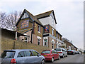

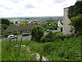


72 photos from this area
Area Information
Key information about the ME12 3SE including its size, population, and administrative classification.
- Area Type
- Postcode
- Area Size
- 5.5 hectares
- Population
- 1588
- Population Density
- 74 people/km²
House Prices in ME12 3SE
48
Properties
£212,050
Average Sold Price
£41,000
Lowest Price
£428,000
Highest Price
Showing 48 properties
| Address | Type | Beds | Baths | Last Sale Price | Last Sale Date | |
|---|---|---|---|---|---|---|
| Romali, 38 Nelson Avenue, Minster On Sea, ME12 3SE | Bungalow | 3 | 1 | £290,000 | Jun 2024 | |
| 16 Nelson Avenue, Minster On Sea, ME12 3SE | Retail | 4 | 2 | £375,000 | Sep 2022 | |
| Blossoms, 39 Nelson Avenue, Minster On Sea, ME12 3SE | Bungalow | - | - | £360,000 | Jul 2022 | |
| Cavet, 25 Nelson Avenue, Minster On Sea, ME12 3SE | Retail | 3 | 1 | £286,000 | Feb 2022 | |
| Chrislyn, Nelson Avenue, Minster On Sea, ME12 3SE | Bungalow | - | - | £260,000 | Sep 2021 | |
| 12 Nelson Avenue, Minster On Sea, ME12 3SE | Detached | 4 | - | £428,000 | Jun 2021 | |
| Rose View, 27 Nelson Avenue, Minster On Sea, ME12 3SE | Bungalow | 3 | - | £330,000 | Feb 2021 | |
| Benbow, Nelson Avenue, Minster On Sea, ME12 3SE | Bungalow | - | - | £425,000 | Sep 2020 | |
| Pandora, Nelson Avenue, Minster On Sea, ME12 3SE | Bungalow | 3 | 1 | £350,000 | Aug 2020 | |
| 41 Nelson Avenue, Minster On Sea, ME12 3SE | Bungalow | 3 | 1 | £275,000 | Aug 2019 |
Page 1 of 5
Energy Efficiency in ME12 3SE
Amenities
Schools
| Rank | School | Type | Entry gender | Ages |
|---|
Explore more schools in this area
Go to Schools tabDemographics
Household Size
Two person
most common
Accommodation Type
Houses
most common
Tenure
80
majority
Ethnic Group
White
most common
Religion
N/A
most common
Household Composition
N/A
most common
Age
47
median
Adults (30-64 years)
most common
Household Deprivation
N/A
with no deprivation
NS-SEC
28
in Lower managerial occupations
Explore more demographic insights in this area
Go to Demographics tabPlanning
Planning Constraints
- Flood RiskPremium
- Ramsar Wetland SitesPremium
- Area of Outstanding Natural BeautyPremium
- Protected Nature ReservePremium
- Protected WoodlandPremium